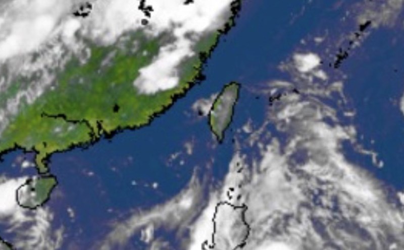
The latest storm and low pressure information on the morning of September 15 from the Philippine Atmospheric, Geophysical and Astronomical Services Administration (PAGASA) said that low pressure near East Sea 09c has entered the East Sea.
The bulletin stated that at 2:00 a.m. on September 15, low pressure 09c was 215 km west of San Joe, Western Mindoro, Philippines.
Forecasters in the Philippines said that the low pressure being monitored inside the Philippine PAR forecast area is unlikely to strengthen into a tropical depression within the next 24 hours.
Although unlikely to become a tropical depression or a low pressure off the west coast of San Jose, Occidental Mindoro is expected to bring rain to some areas of the Philippines, including Metro Manila.
The weather expert Daniel James Villamil of the Philippine State Weather Agency pointed out that due to the influence of low pressure, cloudy skies with scattered showers and thunderstorms are forecast to occur in the Ilocos area, Cordillera administrative region, Central Luzon, Calabarzon (Cavite, Laguna, Batangas, Rizal and Quezoln), Mimaropa (Mindoro, Marinduque, Romblon and Palawan) and Western Visayas.
He warned that flash floods or landslides can occur due to moderate rain, sometimes very heavy rain in the above areas.
Meanwhile, Cagayan Valley will record similar weather patterns due to winter winds, winds blowing from the Pacific Ocean carrying hot and moist air.
The weather forecast for September 15 in the remaining areas of the Philippines is cloudy, gloomy, with scattered showers or local thunderstorms.
PAGASA weather expert Daniel James Villamil added that low pressure 09c may leave PAR on September 16.
In the latest storm and low pressure information from the US Navy's Joint Typhoon Warning Center (JTWC), this low pressure in the East Sea is called Invest 98W.
The bulletin said that 98W is in western Luzon, Philippines and is unlikely to strengthen in the next 24 hours.
JTWC forecasters said that global models show that 98W will continue to move west with little chance of strengthening.
The Philippines has recorded 12 named storms or tropical depressions in the 2025 typhoon season, including two systems that formed in September, including Tropical Depression Kiko and Tropical Depression Lannie. Both Kiko and Lannie were in the PAR for just a few hours.
PAGASA has previously forecast that two to four tropical storms could form within or enter the PAR in September.
Over the weekend, the Hong Kong Meteorological Station (China) said that there are expected to be 3 consecutive low pressure areas forming near the East Sea, of which at least 2 low pressure areas are likely to strengthen into storms.
It is forecasted that the first low pressure near the East Sea will be relatively weak after entering the East Sea. The second low pressure near the East Sea will move north towards China and approach the coast of Guangdong province in the middle and the end of next week.
The third low pressure is forecast to be stronger than the first two low pressure areas but will approach Taiwan (China) and the Luzon Strait this weekend.


