The Philippine Atmospheric, Geophysical and Astronomical Services Administration (PAGASA) said that the newly formed low pressure area is likely to strengthen into a storm in the next 24 hours, with a complex movement and could affect Northern Luzon - Philippines before approaching the East Sea.
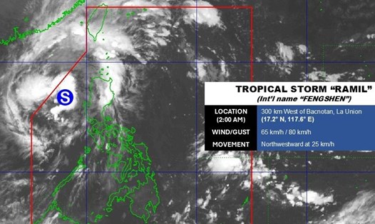
According to the latest storm news from PAGASA, at 3:00 a.m. on October 22, the center of low pressure pressure area 10g was at about 23.8 degrees North latitude; 123.8 degrees East longitude, 370km north of Northeast of Itbayat Island, Batanes Province. This low pressure is highly likely to become a tropical depression/storm, and when it strengthens, it will be named Salome - the next storm after storm No. 12 Fengshen active in the East Sea.
According to the storm forecast model, the low pressure moves southwest under the impact of a cold air mass from the North, causing this low pressure area to gradually slide southwest. While moving, storm Salome may increase in intensity but its trajectory is still quite complex.
The forecast shows that storm Salome is unlikely to move south of the Philippines, but is likely to remain in the northernmost area of the PAR forecast area for the next 1-2 days, then may affect the East Sea.
According to the 7am weather forecast on October 22, the Philippines is currently simultaneously affected by 4 weather systems including: Low pressure in Northern Luzon; Tropical convergence zone on Mindanao; East wind affecting Central and Eastern Luzon; Weak northeast monsoon in the northernmost islands.
Experts say that if Salome strengthens into a storm in the next 24 hours, its path and ability to enter the East Sea will be factors that need to be closely monitored, especially in the context of storm No. 12 still active.
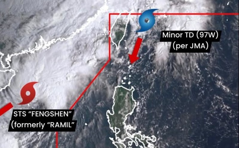
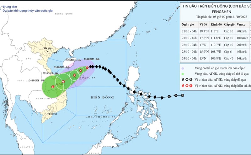
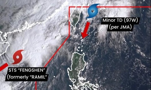
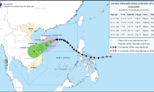
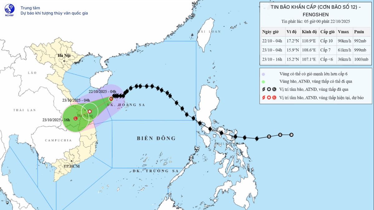
Regarding storm No. 12, at 6:00 a.m. on October 22, the center of the storm was at about 17.1 degrees North latitude; 110.7 degrees East longitude, about 280km East Northeast of Da Nang City.
The strongest wind near the storm center is level 10 (89-102km/h), gusting to level 12. It is forecasted that in the next 3 hours, the storm will move in a West-Southwest direction, at a speed of about 10km/h.
According to the Vietnam National Center for Hydro-Meteorological Forecasting (NCHMF), due to the influence of storm circulation and cold air combined with East wind disturbances and terrain effects, from noon on October 22 to October 27, the area from Ha Tinh to Quang Ngai will have widespread heavy rain (heavy rain will be concentrated from the afternoon of October 22 to the end of October 23).
Total rainfall is generally in: Ha Tinh to Bac Quang Tri and Quang Ngai about 200-400mm, locally over 500mm; the South Quang Tri area to Da Nang City is generally 500-700mm, locally over 900mm. Warning of heavy rain (>200mm/3 hours).
Heavy rain in the Central region is likely to last until the end of October 2025. There is a high risk of flash floods and landslides in mountainous areas, flooding in low-lying areas and urban areas.
Localities need to pay attention to safe operation of hydroelectric and irrigation reservoirs before, during and after the storm, and prepare response plans for flood scenarios on rivers from Quang Tri to Quang Ngai that are likely to reach alert level 3 and exceed alert level 3. Forecast of natural disaster risk level due to floods: level 3.