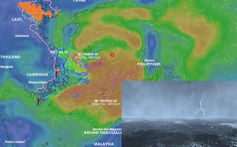
The latest storm and low pressure information on June 9 from the Hong Kong Meteorological Station (China) said that the low pressure in the East Sea appeared near Luzon, Philippines, and could gradually strengthen into a storm in the middle of the East Sea in the next 2 to 3 days.
If the low pressure in the East Sea strengthens into a storm, it will be the first tropical storm of the year in the northwest Pacific and the East Sea. The first storm of the season will be named Wutip, which means " butterfly".
An artificial intelligence model developed by Europe, which was cited by the Hong Kong Meteorological Station (China), predicts that Typhoon Wutip will be a relatively strong typhoon. According to global weather models released by the US Navy's Joint Typhoon Warning Center, the low pressure area is expected to strengthen into Typhoon Wutip and is expected to strengthen in the coming days thanks to warm sea surface temperatures and low wind shear.
Satellite images on June 8 showed that the northern part of the East Sea and the coast of Guangdong (China) are being affected by a high pressure that causes very hot weather. The high-pressure system is expected to maintain hot weather conditions across southern China through June 11. Meanwhile, the low pressure area near Luzon, combined with moisture from the southwest monsoon, is creating favorable conditions for convective activities.
China's typhoon forecasters note that many computer models show that the system will gradually strengthen over the East Sea in the coming days, with the possibility of the typhoon moving to Hainan Island and the west coast of Guangdong province by mid-week. However, there is still a possibility that storm No. 1 Wutip will turn east of Guangdong.
The Hong Kong (China) Weather Agency is expected to issue a warning signal for storm No. 1 as early as the night of June 10 because the low pressure area in the East Sea is expected to strengthen into a tropical storm and move towards Hong Kong (China) in the context of very hot weather.
"Depending on the distance from Hong Kong (China) and the rate of the typhoon's development, the meteorological station will assess the need to issue a higher tropical storm warning signal by the end of May 11 and 12," the Hong Kong (China) weather agency said.
Typhoon forecasters point out that tropical storms approaching Hong Kong (China) from the west often lead to more severe weather for Hong Kong (China) than storms approaching from the east.
The typhoon season in Hong Kong (China) is expected to start in June and last until around October. The Hong Kong Meteorological Station (China) forecasts that there will be 5 to 8 storms appearing in the 2025 typhoon season.