The Philippine Atmospheric, Geophysical and Astronomical Services Administration (PAGASA) said on the morning of August 25 that the low pressure area combined with the southwest monsoon will cause widespread showers and thunderstorms in many areas, including places with moderate to heavy rain with the risk of flash floods and landslides.
According to the storm/low pressure forecast bulletin issued at 3:00 a.m. on August 25, the center of the low pressure was at about 10.2 degrees North latitude, 128.5 degrees East longitude, about 365km east of Maasin city, Southern Leyte province. It is forecasted that in the next 24 hours, the possibility of the low pressure area strengthening into a storm is low, but the impact combined with the southwest monsoon will affect many areas with heavy rain.
Mr. Daniel James Villamil - PAGASA weather forecaster - said that scattered thunderstorms will cover the Visayas region, Bicol region, Northern Mindanao, Caraga and Quezon province. Meanwhile, the Zamboanga peninsula, Western Mindanao and Palawan will also experience moderate to heavy rains due to the direct impact of the southwest monsoon.
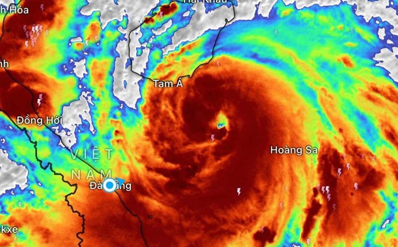
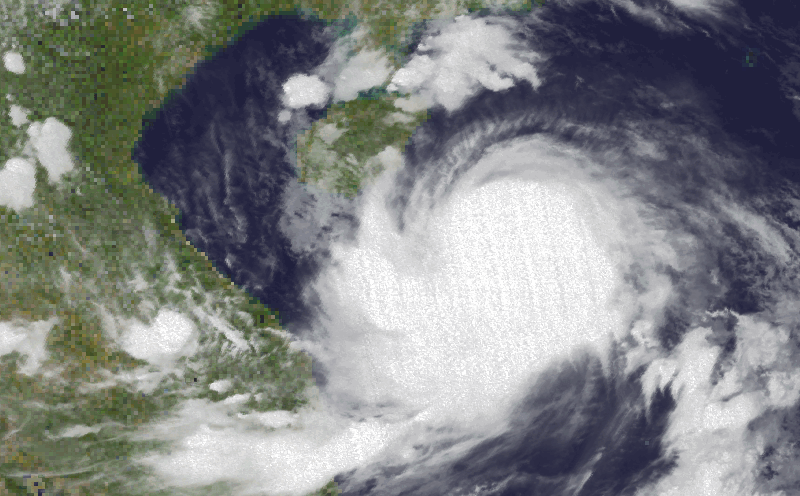
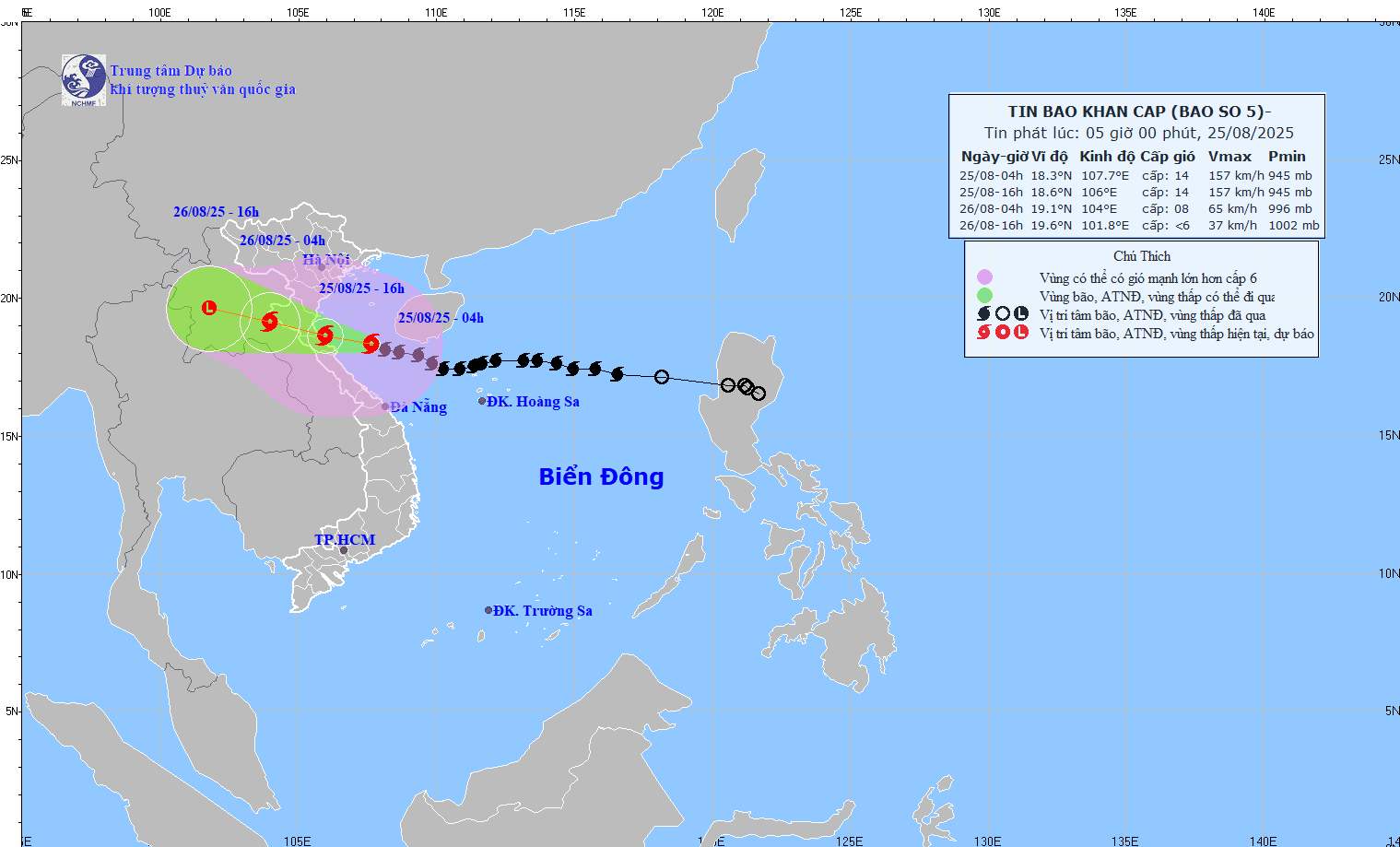
Meanwhile, according to the Vietnam National Center for Hydro-Meteorological Forecasting, at 4:00 a.m. on August 25, the center of storm No. 5 was at about 18.3 degrees North latitude; 107.7 degrees East longitude, about 220km East Southeast of Nghe An, about 200km East Southeast of Ha Tinh, about 180km East Northeast of Bac Quang Tri.
The strongest wind is level 14 (150-166km/h), gusting to level 17. It is forecasted that in the next 3 hours, the storm will move in a West-Northwest direction, at a speed of about 15-20km/h.
Due to the impact of storm No. 5, many stations have recorded strong winds: Bach Long Vi level 7, gusting 9; Co To level 6, gusting 9; Bai Chay level 6, gusting 8; Hon Ngu level 7, gusting 8; Con Co level 6, gusting 8.
It is forecasted that by 4:00 p.m. on August 25, storm No. 5 will be strong at level 14, gusting to level 17 in the coastal waters of Thanh Hoa - Bac Quang Tri 14, moving in the West Northwest direction, about 20km/h.
At 4:00 a.m. on August 26, the center of the storm was at 19.1 degrees North latitude, 104.0 degrees East longitude; in the Central Laos area, moving in the West Northwest direction, about 20km/h. Strong storm level 8, gust level 11.
The northern Gulf of Tonkin, the sea area from Thanh Hoa to Quang Tri (including Hon Ngu island, Con Co special area) is at risk of level 3 natural disasters. Coastal areas from Thanh Hoa to Quang Tri, mainland provinces from Thanh Hoa to the North of Quang Tri are at risk of natural disasters level 4.
At 4:00 p.m. on August 26, the center of the storm was at 19.6 degrees North latitude, 101.8 degrees East longitude; in the Central Laos area and gradually weakened, below level 6.
Regarding heavy rain forecast:
September 25-26: The Northern Midlands and Delta, Lao Cai, Thanh Hoa - Hue will have rain of 100-150mm, locally >250mm.
Thanh Hoa - Bac Quang Tri: 200-400mm, locally >700mm (some places >200mm/3 hours).
Hanoi: moderate to heavy rain, thunderstorms.
Da Nang (August 25): moderate rain, thunderstorms.
Ho Chi Minh City (25-26.8): Showers, thunderstorms in the afternoon and evening.
Upper and Central Laos (25-27.8) 100-250mm, locally >500mm.
Weather forecast for today in Hanoi: Lowest temperature 23-25 degrees. The highest temperature is 27-29 degrees. Cloudy, moderate rain, heavy rain and thunderstorms, locally very heavy rain. North to northeast wind level 3-4. During thunderstorms, there is a possibility of tornadoes, lightning and strong gusts of wind.