According to the National Center for Hydro-Meteorological Forecasting, at 7:00 p.m. on September 22, the center of storm No. 9 was at about 19.5 degrees North latitude; 120.5 degrees East longitude, in the sea northwest of Luzon Island (Philippines).
The strongest wind near the storm center is level 17 (202-221 km/h), gusting over level 17. The storm is moving west-northwest at a speed of 20-25 km/h.
It is forecasted that from September 24, the Gulf of Tonkin and the sea areas of Quang Ninh will be directly affected by the super typhoon. The wind gradually increased to level 8-10, near the storm center level 11-12, gusting to level 15; waves 5-7m high, the sea was very rough.
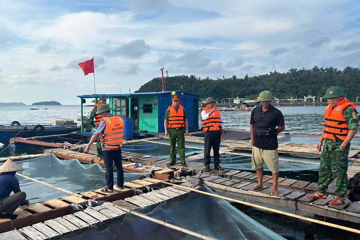
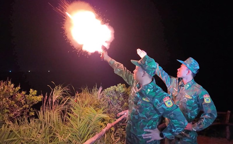
Faced with the complicated developments of the storm, Co To Border Guard Station proactively fired warning flares, and at the same time sent officers and soldiers to coordinate with local authorities to review and call on ships operating at sea to urgently enter safe anchorage areas, absolutely not allowing fishermen and vehicles to stay in dangerous areas.
Previously, Thanh Lan Border Guard Station coordinated with the Co To Special Zone Working Group to propagate and mobilize fishermen to avoid the storm.
During the two days of September 21-22, the unit mobilized 2 high-speed boats and 10 officers and soldiers to coordinate with the police and local forces, bringing 191 ships, boats, and cages to the port to take shelter from the storm.
Currently, the Working Group is continuing to propagate and mobilize the remaining vessels to urgently return to shore, to ensure absolute safety for fishermen and vessels.