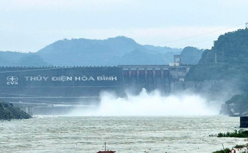
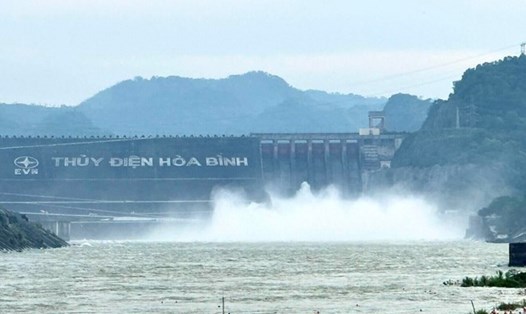
As of 7:00 a.m. on October 21, 2025, according to an update from Vietnam Electricity Group, Hoa Binh Lake recorded upstream water levels at elevation of 116.48m; water flow to the lake reached 3,076m3/s; total discharge was 4,208m3/s.
Implementing the inter-reservoir operation process in the Red River basin, Hoa Binh Hydropower Plant opened a bottom spillway gate at 11:00 on October 20 to stabilize the downstream flow.
At Tuyen Quang Lake, by 7:00 a.m. on October 21, the upstream water level reached 119.58 m; the water flow to the lake reached 648 m3/s; the total discharge was 566.44 m3/s. Implementing the inter-reservoir operation process in the Red River basin, Tuyen Quang Hydropower Plant closed 1 bottom spillway gate of Tuyen Quang Hydropower Plant at 5:00 p.m. on October 16.
As of 7:00 a.m. on October 21, Son La Lake had an upstream water level of 214.94 m; water flow to the lake was 1,179 m3/s; total discharge was 1,735 m3/s. Currently, the unit has closed all bottom spillways, only maintaining power generation through generators to regulate the flow downstream.
A similar situation occurred in Lai Chau Lake, where the upstream water level reached 294.99m; the water flow to the lake reached 1,028m3/s; the total discharge was 1,131m3/s. Currently, Lai Chau Hydropower Plant has also closed all bottom spillways, only operating power generation.
At Thac Ba Lake, by 7:00 a.m. on October 21, the upstream water level reached 57.98 m; the water flow to the lake reached 317 m3/s, the total discharge was 322.35 m3/s. Currently, Thac Ba Hydropower Plant maintains open 1 spillway.
In the context of complicated heavy rain, the flexible operation of hydroelectric reservoirs, ensuring safety downstream is considered a key factor in natural disaster prevention in the North.
According to the National Center for Hydro-Meteorological Forecasting, Typhoon Fengshen has entered the eastern sea area of the North East Sea, becoming the 12th storm of 2025.
At 4:00 a.m. on October 21, the center of storm No. 12 was at about 18.3 degrees north latitude - 113, east longitude; about 200 km north-northeast of Hoang Sa Special Zone.
The strongest wind near the storm center is level 9 - 10 (75 - 102 km/h), gusting to level 12. The storm is moving westward at a speed of about 20 km/h.
On land, due to the influence of storm circulation combined with cold air, easterly wind disturbances and terrain effects, from the night of October 22 to October 26, the area from Ha Tinh to Quang Ngai is highly likely to experience widespread heavy rain.
The total rainfall from Ha Tinh to northern Quang Tri and Quang Ngai is about 200 - 400 mm, in some places over 500 mm; the area from southern Quang Tri to Da Nang City is generally 500 - 700 mm, in some places over 900 mm.
Heavy rain in the Central region is likely to last until the end of October 2025.
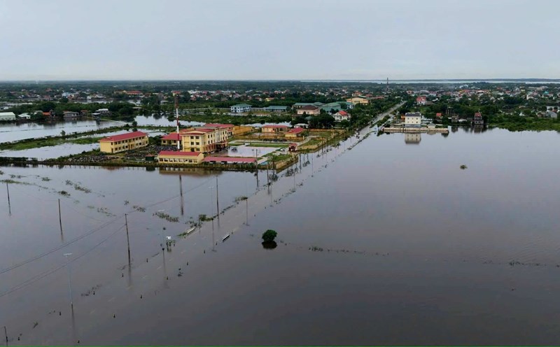
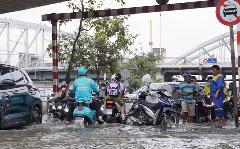
There is a high risk of flash floods and landslides in mountainous areas, flooding in low-lying areas and urban areas. Localities need to pay attention to safe operation of hydroelectric reservoirs and irrigation before, during and after the storm; prepare response plans for flood scenarios on rivers from Quang Tri to Quang Ngai that may reach alert level 3 and exceed alert level 3. The forecast level of natural disaster risk due to floods and inundation is level 3.