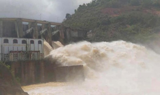
As of 7:00 a.m. on November 5, 2025, according to an update from Vietnam Electricity Group, Hoa Binh Lake recorded upstream water levels at elevation of 116.72m; water flow to the lake reached 982m3/s; total discharge was 3,654m3/s.
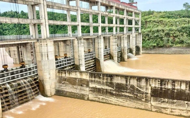
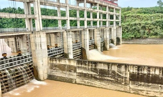
Implementing the inter-reservoir operation process in the Red River basin, Hoa Binh Hydropower Plant opened a bottom spillway at 10:00 p.m. on November 4, 2025 to ensure flood safety.
At Tuyen Quang Lake, by 7:00 a.m. on November 5, the upstream water level reached 120.03 m; the water flow to the lake reached 233 m3/s; the total discharge was 184.46 m3/s. Implementing the inter-reservoir operation process in the Red River basin, Tuyen Quang Hydropower Plant closed 1 bottom spillway gate of Tuyen Quang Hydropower Plant at 6:00 p.m. on October 24.
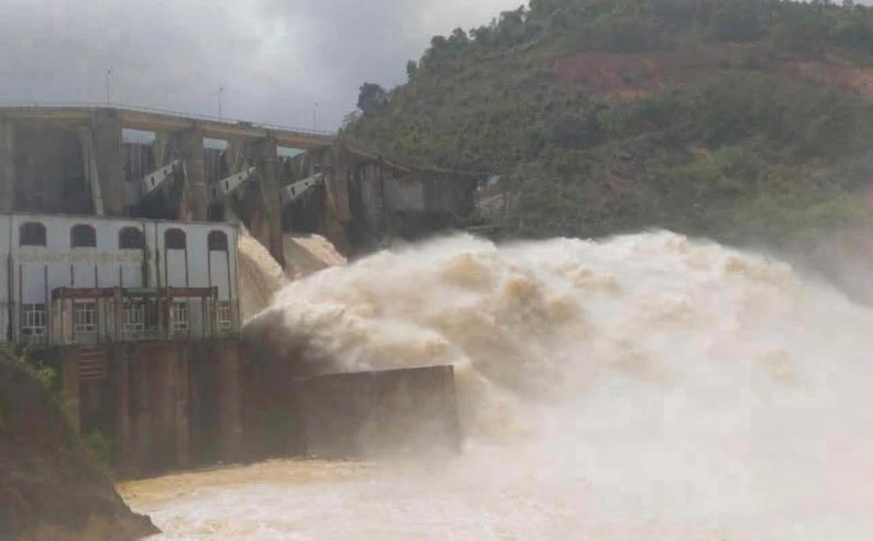
As of 7:00 a.m. on November 5, Son La Lake had an upstream water level of 216.4 m; the water flow to the lake was 2,557 m3/s; the total discharge was only 890 m3/s. Currently, the unit has closed all bottom spillways, only maintaining power generation through generators to regulate the flow downstream.
At Lai Chau Lake, by 7:00 a.m. on November 5, the upstream water level reached 294.99 m; the water flow to the lake reached 1,705 m3/s; the total discharge was 1,759 m3/s. Currently, Lai Chau Hydropower Plant is opening a facial opening.
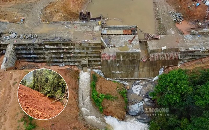
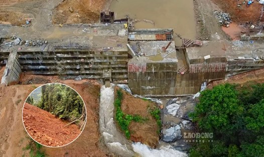
A similar situation occurred at Thac Ba Lake, where the upstream water level reached 58.08m; the water flow to the lake reached 200m3/s; the total discharge was 373.02m3/s. Currently, Thac Ba Hydropower Plant is opening 2 floodgates.
In the context of complicated heavy rain, the flexible operation of hydroelectric reservoirs, ensuring safety downstream is considered a key factor in natural disaster prevention in the North.
According to the National Center for Hydro-Meteorological Forecasting, today, November 5, storm No. 13 Kalmaegi officially entered the East Sea.
On the evening of November 5, the center of the storm was at about 12.3 degrees North latitude - 116.0 degrees East longitude, about 220 km northeast of Song Tu Tay Island. The storm is moving west-northwest at a speed of 20-25km/h and is likely to strengthen.
The strongest wind near the storm center is level 13-14, gusting to level 17. Natural disaster risk level: level 4 for the Central East Sea area (including the sea area north of Truong Sa special zone).
Due to the influence of the storm, the Central East Sea area (including the sea area north of Truong Sa special zone) will gradually increase to level 7-8, then increase to level 9-11; the area near the storm's eye will be strong at level 12-14, gusting to level 17, waves 5.0-4.0m high, the area near the storm's eye will be 8.0-10.0m high; the sea will be very rough.
From early morning on November 6, the sea area from Da Nang City to Khanh Hoa (including Ly Son special zone) will have winds gradually increasing to level 6-7, then increasing to level 8-11, the area near the storm's eye will have strong winds of level 12-14, gusting to level 17. Coastal areas from Hue City to Dak Lak have waves 4.0-6.0m high, near the storm's eye 6.0 8.0m high; rough seas.
From the evening of November 6, on the mainland along the coast from South Quang Tri to Da Nang, the East of Quang Ngai and Dak Lak provinces, the wind will gradually increase to level 6-7, then increase to level 8-9, the area near the storm's eye will have strong winds of level 10-12 (focusing on the East of Quang Ngai - Dak Lak provinces), gusting to level 14-15. In the West of Quang Ngai and Gia Lai provinces, the wind gradually increased to level 6-7, near the storm's eye, it passed strongly at level 8, gusting to level 10.