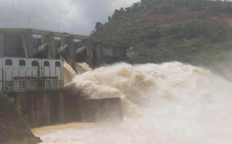
As of 8:00 a.m. on November 1, 2025, according to an update from Vietnam Electricity Group, Hoa Binh Lake recorded upstream water levels at elevation of 116.46m; water flow to the lake reached 543m3/s; total discharge was 1,676m3/s.
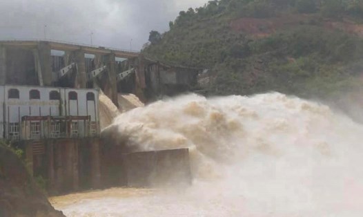
Implementing the inter-reservoir operation process in the Red River basin, Hoa Binh Hydropower Plant closed a bottom spillway gate at 11:00 on October 22 to stabilize downstream flow. When closing a bottom spillway, the downstream water level will gradually decrease.
At Tuyen Quang Lake, by 7:00 a.m. on November 1, the upstream water level reached 119.51 m; the water flow to the lake reached 325 m3/s. Implementing the inter-reservoir operation process in the Red River basin, Tuyen Quang Hydropower Plant closed 1 bottom spillway gate of Tuyen Quang Hydropower Plant at 6:00 p.m. on October 24.
As of 8:00 a.m. on November 1, Son La Lake had an upstream water level of 214.96 m; water flow to the lake was 800 m3/s; total discharge was 965 m3/s. Currently, the unit has closed all bottom spillways, only maintaining power generation through generators to regulate the flow downstream.
A similar situation occurred in Lai Chau Lake, where the upstream water level reached 294.82m; the water flow to the lake reached 764m3/s; the total discharge was 555m3/s. Currently, Lai Chau Hydropower Plant has also closed all bottom spillways, only operating power generation.
At Thac Ba Lake, by 8:00 a.m. on November 1, the upstream water level reached 58.02 m; the water flow to the lake reached 225 m3/s, the total discharge was 270.86 m3/s. Currently, Thac Ba Hydropower Plant maintains all floodgates closed.
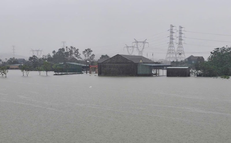
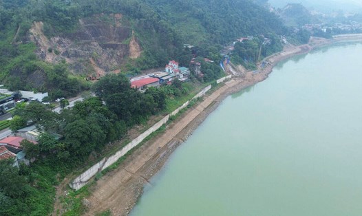
In the context of complicated heavy rain, the flexible operation of hydroelectric reservoirs, ensuring safety downstream is considered a key factor in natural disaster prevention in the North.
According to the National Center for Hydro-Meteorological Forecasting, today, November 1, due to the influence of cold air combined with disturbances in the East wind zone, the Northeast region will have rain in many places.
The Northern and North Central regions will have rain, cold weather, and some mountainous areas in the North will be cold. The lowest temperature is generally 18-21 degrees Celsius, in mountainous areas it is below 17 degrees Celsius.
At sea, the Gulf of Tonkin has northeast winds of level 5, sometimes level 6, gusting to level 7-8, rough seas, waves 1.5 - 2.5m high. The northern sea area of the North East Sea will have northeast winds of level 6, gusting to level 7-8, rough seas, waves 2.0 - 4.0m high.
The sea area from South Quang Tri to Quang Ngai: northeast wind level 5, sometimes level 6, gust level 7-8, rough seas, waves 2.0 - 3.0m high.
The area from Ha Tinh to Da Nang City will have heavy to very heavy rain with common rainfall of 200-400mm, locally over 700mm. In the South of Nghe An and Quang Ngai, there will be heavy rain with common rainfall of 100-200mm, locally very heavy rain over 300mm.
Heavy rain is likely to cause flooding in low-lying areas; flash floods on small rivers and streams; landslides on steep slopes. During thunderstorms, there is a possibility of tornadoes, lightning, hail and strong gusts of wind.