Environment

Storm No. 1 gusting at level 10 is moving very slowly, continuing to cause heavy rain
|
Typhoon No. 1 is still maintaining intensity level 8, gusting level 10 in the southern area of Guangxi province (China), 120km north-northeast of Mong Cai (Quang Ninh).

Warning to provinces and cities with heavy rain today, in some places over 150mm
|
On July 5, the Northeast region, Lai Chau, Dien Bien, Son La and Lao Cai provinces will have moderate to heavy rain; meanwhile, the Central and Southern regions will have scattered showers and thunderstorms.

Storm No. 1 has moved to China but still causes heavy rain, dangerous weather
|
Typhoon No. 1 has entered southern Guangxi province (China), but the typhoon's circulation continues to cause dangerous weather in the Northeast region.

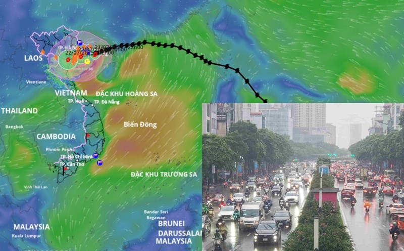
Weather today July 5th: Northern region has places with heavy to very heavy rain due to the circulation of storm No. 1
|
Weather today July 5, the Northeast region has moderate rain, heavy rain, and very heavy rain in some places due to the influence of storm No. 1's circulation.

Forecast of heavy rain in the area today July 5 due to storm No. 1 circulation, in some places over 300mm
|
Due to the circulation of storm No. 1, today July 5, the Northeast region continues to have moderate to heavy rain, with very heavy rain in some places. Quang Ninh coast has strong winds at level 6-7, gusts at level 9-10.
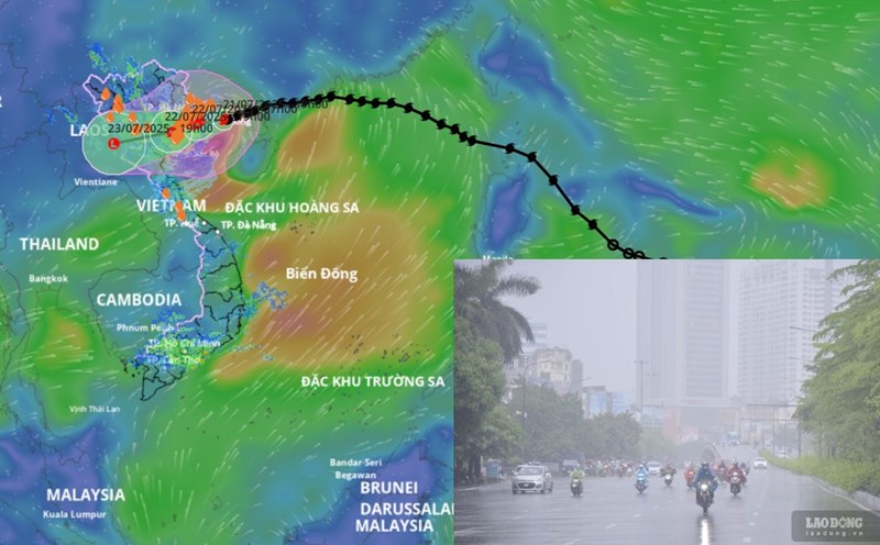
Latest forecast of when typhoon No. 3 Wipha will make landfall in Hai Phong and Ninh Binh
|
According to the representative of the meteorological agency, storm No. 3 Wipha is about to make landfall in Hai Phong and Ninh Binh, causing increased rainfall today, July 22.

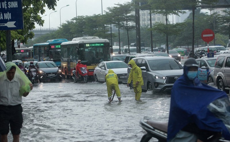
Hanoians proactively prune trees and use sandbags to block doors before the storm makes landfall
|
Hanoi residents urgently cut down trees, cover their houses, reinforce their basements, and place sandbags to prevent storms. The streets were unusually quiet before the storm made landfall.
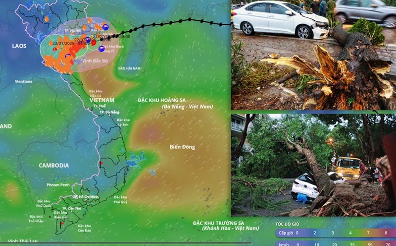
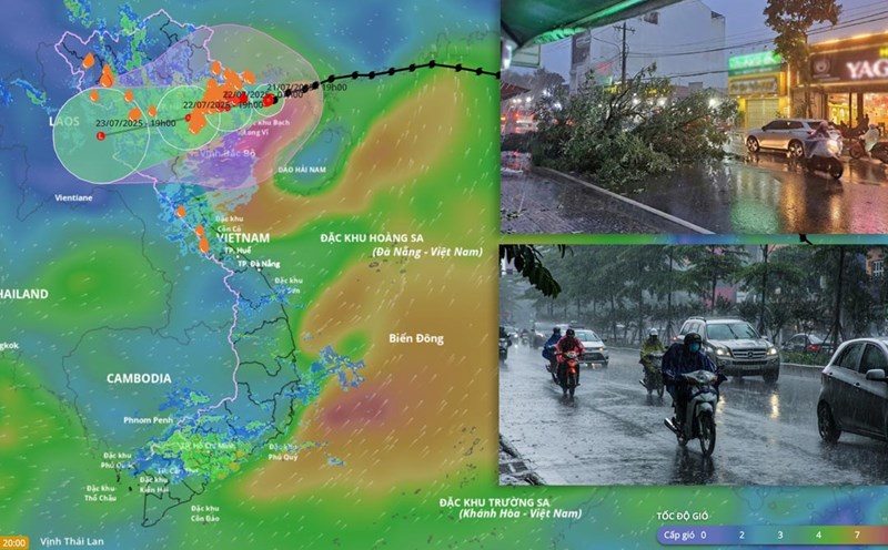
After 10am this morning, storm No. 3 Wipha made landfall in Hai Phong and Ninh Binh
|
According to the representative of the meteorological agency, after around 10:00 a.m. this morning, July 22, storm No. 3 Wipha will enter the area of South Hai Phong and Ninh Binh.
Weather today, September 22: Heavy to very heavy rain in the North and North Central regions
|
Weather today, July 22, the Northern region, Thanh Hoa and Nghe An will have heavy to very heavy rain and thunderstorms.

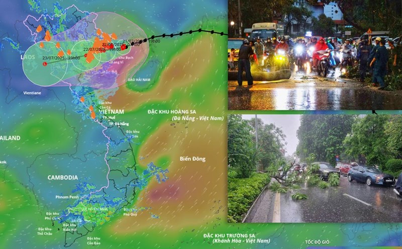
Morning in the West 22.7: Houses collapse, trees fall due to the impact of storm No. 3 in Phu Quoc
|
Morning in the West 22.7: The Prime Minister requested to shorten the construction time of Chau Doc - Can Tho - Soc Trang Expressway; Houses collapsed, trees fell due to the impact of storm No. 3 in Phu Quoc,...
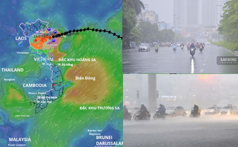
Storm No. 3 Wipha is about to make landfall, forecasting the time to cause the strongest rain and wind
|
According to the meteorological agency, it is forecasted that by noon this afternoon, July 22, storm No. 3 Wipha will make landfall from Hai Phong to Thanh Hoa; causing heavy rain and strong winds today.
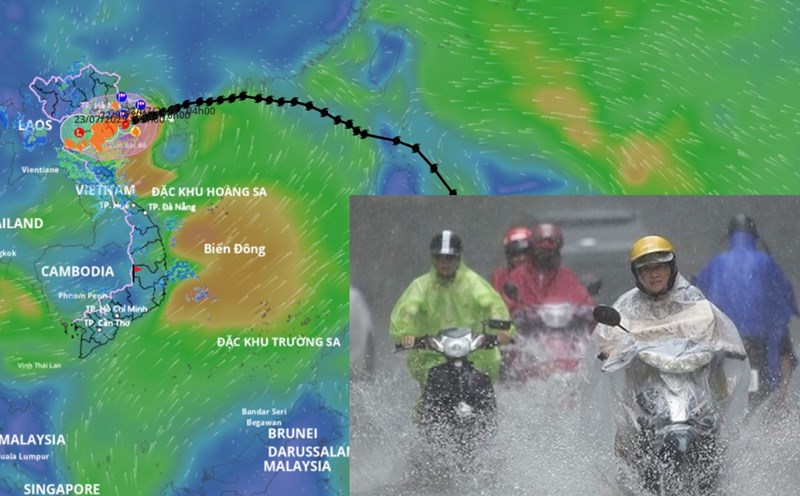
Storm No. 3 Wipha is only 80km from Quang Ninh, about to strengthen to level 14
|
According to the meteorological agency, storm No. 3 Wipha is only about 80 km from Quang Ninh. It is forecasted that in the next 12 hours, the storm will increase to level 1, level 11 strength, gust level 14.
Storm No. 3 Wipha is about to cause heavy rain and strong winds in Hanoi, forecast for key communes and wards
|
On the evening of July 21, the Northern Hydrometeorological Station issued detailed forecasts on the impact of storm No. 3 on communes and wards in Hanoi.
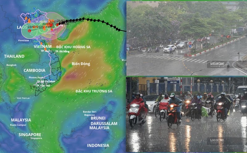
Weather forecast for tomorrow, July 22 nationwide
|
Weather forecast for tomorrow, July 22, Hanoi will have heavy to very heavy rain. Ho Chi Minh City will have scattered showers and thunderstorms in the afternoon and evening.
Forecast of heavy rain and strong winds due to storm No. 3 in Hanoi
|
Due to the wide circulation of storm No. 3, Hanoi is also a locality forecast to be affected by this storm.

Phu Tho orders to release overflow water from Dai Lai Lake
|
Phu Tho - At 1:00 p.m. on July 21, the Provincial Command Committee for Civil Defense - Natural Disaster Prevention and Search and Rescue (PTDS - PCTT&TKCN) issued an Order to release the overflow of Dai Lai Lake.
Forecast of the intensity of storm No. 3 Wipha when making landfall in Hai Phong to Thanh Hoa
|
The meteorological agency said that it is forecasted that tomorrow evening, July 22, storm No. 3 Wipha will be strong at level 9, gusting to level 11 when on land from Hai Phong to Thanh Hoa.
Forecast of communes and wards strongly affected by storm No. 3 Wipha
|
Tonight, July 21, the meteorological agency has provided warning information to a number of key communes and wards affected by storm No. 3 Wipha.
Forecast of the time when storm No. 3 will make landfall and cause the heaviest rain in our mainland
|
On the evening of July 21, Mr. Mai Van Khiem - Director of the National Center for Hydro-Meteorological Forecasting provided the latest analysis and assessment information about storm No. 3.
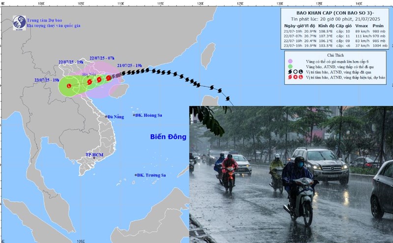
Storm No. 3 Wipha causes heavy rain, strong gusts of wind up to level 8 in Hanoi
|
A representative of the Northern Hydrometeorological Station warned that storm No. 3 Wipha could cause strong gusts of wind up to level 8 in Hanoi from tomorrow afternoon, July wholeheartedly warning of dangerous winds during thunderstorms.