Environment

Storm No. 1 gusting at level 10 is moving very slowly, continuing to cause heavy rain
|
Typhoon No. 1 is still maintaining intensity level 8, gusting level 10 in the southern area of Guangxi province (China), 120km north-northeast of Mong Cai (Quang Ninh).

Warning to provinces and cities with heavy rain today, in some places over 150mm
|
On July 5, the Northeast region, Lai Chau, Dien Bien, Son La and Lao Cai provinces will have moderate to heavy rain; meanwhile, the Central and Southern regions will have scattered showers and thunderstorms.

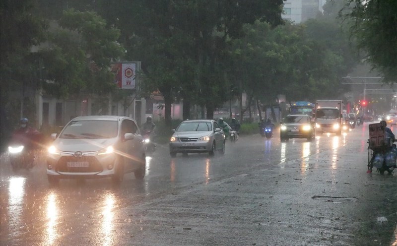
Storm No. 1 has moved to China but still causes heavy rain, dangerous weather
|
Typhoon No. 1 has entered southern Guangxi province (China), but the typhoon's circulation continues to cause dangerous weather in the Northeast region.

Weather today July 5th: Northern region has places with heavy to very heavy rain due to the circulation of storm No. 1
|
Weather today July 5, the Northeast region has moderate rain, heavy rain, and very heavy rain in some places due to the influence of storm No. 1's circulation.

Forecast of heavy rain in the area today July 5 due to storm No. 1 circulation, in some places over 300mm
|
Due to the circulation of storm No. 1, today July 5, the Northeast region continues to have moderate to heavy rain, with very heavy rain in some places. Quang Ninh coast has strong winds at level 6-7, gusts at level 9-10.
Weather today, September 21: Forecast of heavy to very heavy rain in the North
|
Weather today, July 21, due to the impact of storm No. 3, the Northern region, Thanh Hoa, Nghe An will have heavy to very heavy rain and thunderstorms.

Storm No. 3 Wipha is forecast to strengthen to level 15 when entering the Gulf of Tonkin
|
The meteorological agency said that storm No. 3 Wipha will strengthen in the next 24 hours; it is forecast to be strong at level 11-12, gusting to level 15 when entering the northern area of the Gulf of Tonkin.

Storms can be seen for early forecasting, while thunderstorms suddenly hit the water level
|
According to meteorological researchers, thunderstorms in some cases are even more dangerous than storms because they are difficult to predict but can only be warned; the gusts of wind are very strong.

Storm No. 3 Wipha with gusts of level 14 is about to accelerate, forecast to strengthen again
|
According to the meteorological agency, in the next 24 hours, storm No. 3 Wipha is forecast to accelerate at a speed of 20-25km/h and strengthen; entering the Northern Gulf of Tonkin.

Weather forecast for tomorrow, July 21 nationwide
|
Weather forecast for tomorrow, July 21, due to the impact of storm No. 3 Wipha, Hanoi has some places with heavy to very heavy rain and thunderstorms. Ho Chi Minh City will have scattered showers and thunderstorms in the afternoon and evening.

Weather forecast for tonight and tomorrow, July 21
|
Latest weather forecast, July 21: The Northeast region is forecast to have heavy to very heavy rain. Here is the weather forecast for tonight and tomorrow.

Heavy rain and strong winds knock down trees, blown off roofs and caused durian to fall in large numbers in Lam Dong
|
Lam Dong - Heavy rain and strong winds in many communes and wards in the South of Lam Dong caused heavy damage.

Storm No. 3 Wipha makes landfall, 13 provinces and cities must notify vehicle owners
|
The Ministry of Agriculture and Environment has just sent an official dispatch to the People's Committees of 13 provinces and cities on the implementation of the work of ensuring dyke safety in response to storm No. 3 and floods.

Storm No. 3 Wipha forecast to make landfall from Hai Phong to Thanh Hoa in the next 48 hours
|
According to the meteorological agency, in the next 48 hours, storm No. 3 Wipha may make landfall along the coast of Hai Phong - Thanh Hoa provinces.

Thunderstorms develop strongly towards Hanoi, warning of heavy rain
|
The meteorological agency said that thunderstorms are developing strongly and are moving towards Hanoi city, causing rain in the evening and evening of July 20.

Storm No. 3 Wipha is about to cause very heavy rain, warning of flood risk areas
|
Storm No. 3 Wipha is about to cause widespread heavy rain. The meteorological agency has issued a warning of natural disaster risk due to floods on rivers in the North, Thanh Hoa and Nghe An at level 2.

Weather forecast for the next 3 days from July 21 to July 23 in all three regions
|
According to the meteorological agency, the weather forecast for the North and North Central regions in the next 3 days will have heavy to very heavy rain and thunderstorms.

Follow 11 recommendations for responding to storm No. 3 Wipha and floods after the storm
|
The Department of Dyke Management and Natural Disaster Prevention (Ministry of Agriculture and Environment) has instructed on skills to respond to storm No. 3 and floods after the storm.

Forecast of areas strongly affected by storm No. 3 Wipha, dangerous weather
|
According to the meteorological agency, in the next 24 hours, storm No. 3 Wipha is forecast to continue to maintain strong winds, gusting to level 15.

Forecast of heavy rain today in the South
|
HCMC - On July 20, many places in HCMC and the Southern region will have heavy rain, strong winds with thunderstorms.