Environment

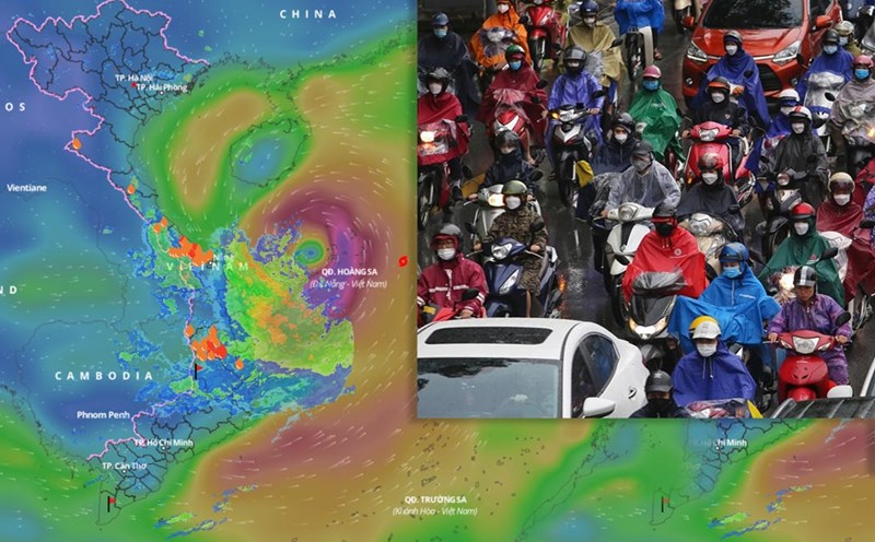
Heavy rain in the North from tonight due to storm No. 1, dangerous weather warning
|
Forecast due to the impact of storm No. 1, from the night of July 3rd to the end of July 5th, the Northeast and Thanh Hoa will have widespread heavy rain, with locally very heavy rain over 350mm.

Voters propose investing in embankments to prevent riverbank and coastal erosion
|
Voters proposed allocating resources to invest in and upgrade embankment works to prevent riverbank and coastal erosion in order to protect people, infrastructure and stabilize life.

Southern region enters the peak of the rainy season, widespread heavy rain is about to appear
|
Entering the peak of the rainy season, the South is forecast to continue to welcome a period of moderate to heavy rain with thunderstorms lasting until July 5.

Storm No. 1 Maysak is expected to make landfall, localities can proactively ban the sea
|
The National Steering Committee for Civil Defense proposed that localities proactively respond to storm No. 1 and post-storm floods.

Forecast of heavy rain in provinces and cities from tonight due to storm No. 1, in some places over 350mm
|
Forecast for the Northeast region and Thanh Hoa to have widespread heavy rain from tonight July 3 due to the impact of storm No. 1.

Weather forecast for tonight and tomorrow, June 12
|
Weather forecast for tonight and tomorrow, September 12: Due to the influence of storm No. 1, the Central Central region will have heavy to very heavy rain.

Provinces with the heaviest rain due to storm No. 1, warn of dangerous weather and what to do immediately
|
Forecast of key areas of heavy rain due to storm No. 1 Wutip are Da Nang, Hue, Quang Nam, Gia Lai, Kon Tum...

mud, sand and gravel overflow into residential areas after heavy rain
|
HUE - Heavy rain caused rocks, sand and gravel from the newly built embankment to overflow, causing flooding near the residential area in lot 86 Le Ngo Cat (Thuan Hoa district).

Storm No. 1 Wutip is about to strengthen, causing very heavy rain, warning of the risk of extreme rain
|
Storm No. 1 Wutip is forecast to continue to strengthen in the next 24 to 48 hours and cause heavy rain in the Central region and the Northern Central Highlands. Warning of the risk of heavy rain over 200mm within 6 hours.

Forecast of 2 scenarios of storm No. 1 Wutip and heavy rain in the next 3 days
|
According to the representative of the meteorological agency, the circulation of storm No. 1 Wutip combined with the southwest monsoon caused heavy rain in the Central region and the northern Central Highlands from the afternoon of June 11.

The embankment of more than 6 billion is completed, people in Tra Cu no longer worry about landslides every night
|
Tra Vinh - The Provincial People's Committee invested more than 6.2 billion VND to build a 300-meter embankment at the Tra Cu riverbank to cope with landslides and protect people living along the river.

Forecast of the strongest intensity of storm No. 1 Wutip and the time to reach the peak
|
According to the meteorological agency, the strongest intensity of storm No. 1 Wutip was around level 10 on June 13.

Forecast of when the rain will decrease in the Southern region
|
HCMC - According to the Southern and Central Highlands Hydrometeorological Station, thunderstorms will gradually decrease in the next 2-3 days.

Hai Phong does not let the process of restructuring the apparatus affect the work of preventing storm No. 1
|
Hai Phong - The City People's Committee has just issued instructions on closely monitoring developments and proactively responding to storm No. 1 Wutip.

Storm No. 1 Wutip is about to strengthen, forecast time of impact on land
|
According to the meteorological agency, storm No. 1 Wutip is likely to strengthen in the next 24 to 48 hours.

Heavy rain is coming, warning of flood risk areas
|
The meteorological agency warned of floods on rivers from Quang Binh to Quang Ngai from the night of June 11 due to heavy rain.

Forecast of the heaviest rain area from tonight due to storm No. 1 Wutip
|
According to the meteorological agency, the forecast of rainfall in the regions is still very complicated, depending on the direction of movement and the impact of storm No. 1 Wutip.

Central region warns boats to avoid storm No. 1 from June 11
|
Central provinces and cities have issued warnings about heavy rain, strong winds and fierce waves at sea, calling on ships to seek shelter from storm No. 1.

Forecast of storms, tropical depressions and the risk of strong storms
|
According to the meteorologist, the forecast for the number of strong storms in 2025 is likely to be equivalent to or higher than the average of many years.
Latest forecast of the path and impact of storm No. 1 Wutip
|
According to the meteorological agency, storm No. 1 Wutip is moving west-northwest at a speed of about 10 km/h and is likely to strengthen in the next 24 hours.