The latest storm and low pressure information on the afternoon of October 9 from the Philippine Atmospheric, Geophysical and Astronomical Services Administration (PAGASA) said that a new low pressure was detected near Coron, Palawan since the morning of the same day.
The new low pressure of 10c was recorded within the Philippine Forecast Area (PAR). This new low pressure is about 180km west-northwest of Coron, Palawan.
Philippine weather forecasters say the new low pressure is unlikely to develop into a tropical depression within the next 24 hours.
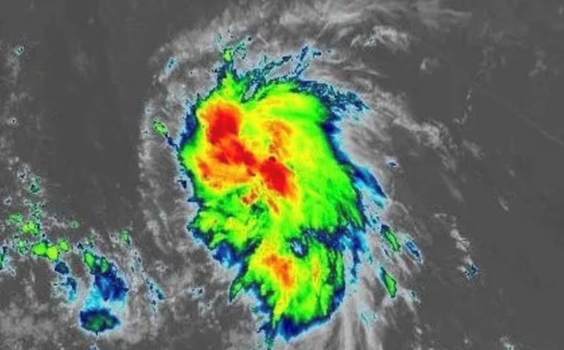
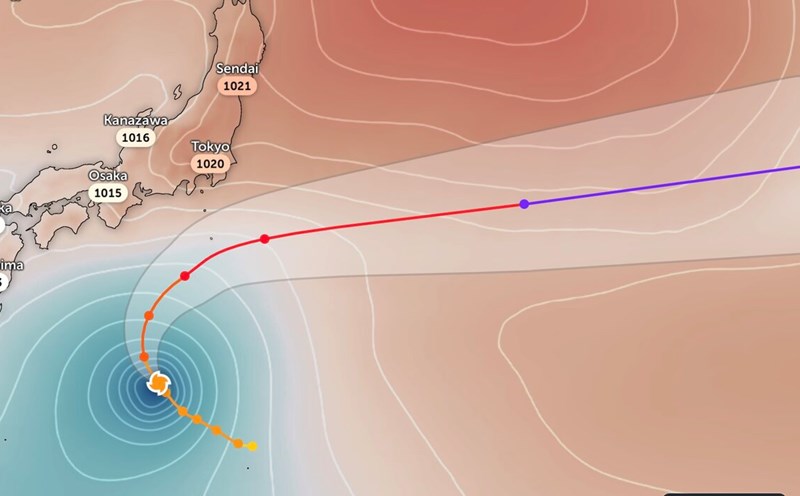
Along with the emergence of a new low pressure in the East Sea, PAGASA is also monitoring Tropical Storm Nakri. According to the update at 12:40 on October 9, Typhoon Nakri entered the Philippine Forecast Area (PAR) and was named Quedan in the Philippines.
Before entering PAR, Typhoon Nakri was 1,445km north of the northernmost tip of Luzon, Philippines, with maximum sustained winds of 75 km/h and gusts of up to 90 km/h. The storm is moving at a speed of 25 km/h northwest.
According to the forecast of storms and low pressure during the week from October 8 to October 21, PAGASA forecasts that in addition to the appearance of Typhoon Nakri, 2 low pressure areas near the East Sea may appear and enter the East Sea in a row. The first low pressure area to appear east of PAR during the week of October 8 to October 14 and is forecast to affect Luzon - Visayas, Philippines weather but is unlikely to strengthen into a storm.
The second low pressure area will appear during the week of October 15 to October 21 within the PAR region. The low pressure will move across Southern Luzon, Visayas and Mindanao to enter the South China Sea. Forecasters say the low pressure is unlikely to become the 12th storm in the South China Sea.
According to the bulletin of the Vietnam National Center for Hydro-Meteorological Forecasting, on October 9, the low pressure trough with an axis at about 12-14 degrees North latitude, connecting with a low pressure area located at 7:00 a.m. at about 12.5-13.5 degrees North latitude; 113.5-114.5 degrees East longitude.
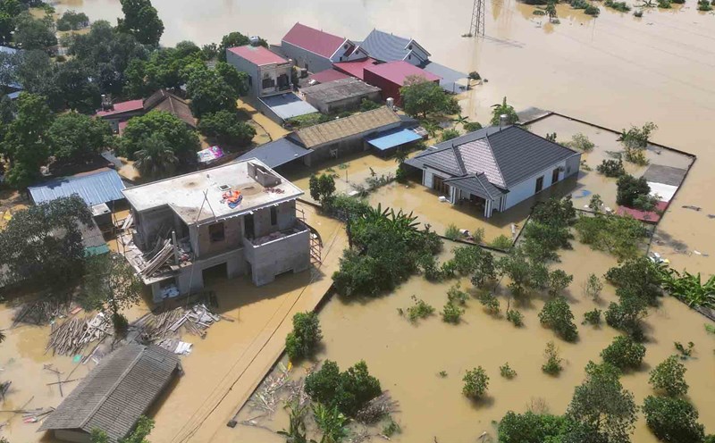
Currently, the central and southern East Sea (including Truong Sa special zone), the sea area from South Quang Tri to Ca Mau and the Gulf of Thailand are having showers and thunderstorms.
It is forecasted that during the day and night of October 9, the above areas will continue to have showers and thunderstorms. During thunderstorms, there is a possibility of tornadoes, strong gusts of wind of level 6-7, and waves over 2m high.