The latest storm news on August 1 said that Typhoon Iona has weakened into a tropical storm in the central Pacific while Typhoon Gil continues to strengthen.
The US National Hurricane Center (NHC) said Gil formed south-southwest in the southern part of Baja California peninsula.
The storm is located about 1,260km south of the peninsula's southern tip, with maximum sustained winds of 72km/h accompanied by stronger gusts. Hurricane Gil is forecast to turn north-northwest over the next few days.
The storm is expected to strengthen over the next few days and Gil will strengthen into a hurricane on August 1, forecasters at the US National Hurricane Center said.
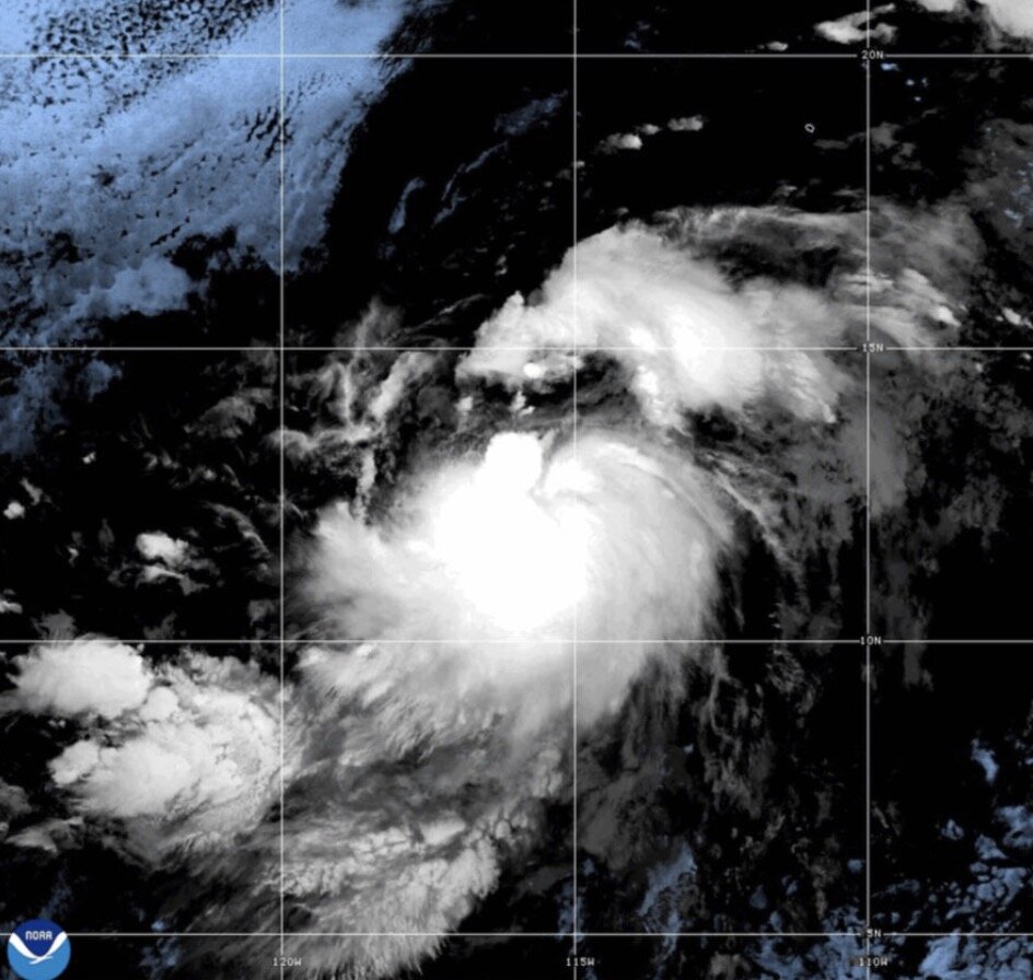
Meanwhile, the center's hurricane bulletin also said that storm Iona will continue moving westward until August 1, then gradually turn north-northwest over the weekend. January has maximum sustained winds of 85 km/h, with stronger gusts.
Tropical storm Iona used to be a hurricane but has weakened. The storm poses no threat to land.
Forecasters say other storms could form in the coming days in the eastern Pacific. In addition to January and Gil, the National Hurricane Center is also monitoring two depressions in the Central and Eastern Pacific.
Invest 92C is in the central Pacific. This low pressure has a 20% chance of strengthening into a tropical depression or tropical storm in the next 2 days.
The second system is Disturbance 2, currently in southern Mexico. This low pressure has a 10% chance of developing into a tropical depression or tropical storm in the next 2 days and a 70% chance of strengthening in the next 7 days.
In the western Pacific, Typhoon Krosa and a low pressure area near the East Sea are active. Krosa is currently south-southeast of Kanto, Japan and is moving north-northwest at a speed of 15 km/h.
According to Japan's typhoon forecasters, Typhoon Krosa could make landfall in the Izu Islands on the night of August 1 and make landfall in Japan's Kanto region, from the night of August 1 to August 2. The country's meteorological officials are warning of high waves and possible disasters due to heavy rain.
According to the forecast, Typhoon Krosa may continue to develop and move at a relatively slow pace. Strong winds are expected across the Izu and Kanto Islands from August 1 to August 2. Maximum sustained winds are expected to reach 126 km/h. Due to the impact of Typhoon Krosa, rough seas are forecast, with waves up to 7m high around the Izu Islands and 6m off the coast of Kanto on August 1.
Meanwhile, the low pressure near the East Sea, named Invest 93W by the Joint Typhoon Warning Center (JTWC) of the US Navy, is located near the Daito Islands, Japan.
JTWC forecasters said that this low pressure is unlikely to strengthen in the next 24 hours. Currently, this low pressure near the East Sea has maximum sustained winds of about 25-35 km/h.