The latest forecast of storms and depressions on 10.2 of the Philippine Astronomy, Geophysical and atmosphere (Pagasa) said a new low pressure will appear in the South China Sea region this week.
Filipino weather forecasts said that low pressure in the South China Sea is expected to appear in PAGASA's Par, TCAD and TCID forecasting areas in the week from October 10 to February 16.
The low pressure in this South China Sea is less likely to become storms.
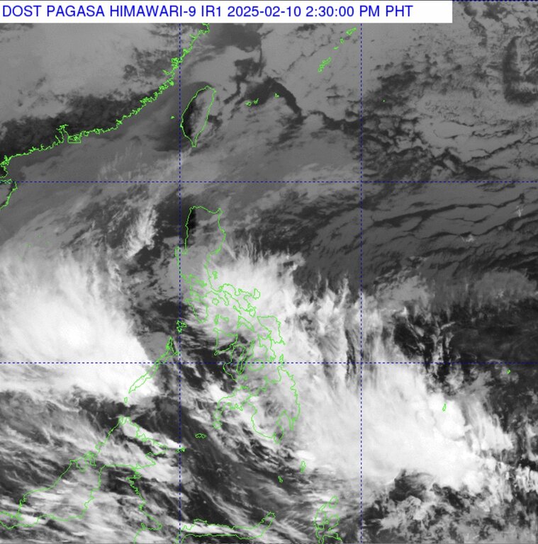
Currently, there are 3 weather systems that are affecting the Philippines, causing rain across the country on October 10, Inquirer information.
Scattered rain and local storms due to the broken wind affecting the areas of Visayas, Bicol, Mimaropa, Quezon and Aurora.
Meanwhile, the East wind is expected to cause scattered rain and local storms in Caraga.
East wind also causes rain in the Metro Manila, Cagayan Valley, Cordillera, the rest in Luzon and Calabarzon.
The Philippine Weather Agency also warned that the rain to heavy rain in the above areas could lead to landslides or flash floods.
The northeast monsoon also leads to small rain in some remaining areas of Luzon, while the winter wind causes rain or thunderstorms in the remaining areas of Mindanao in the afternoon and evening.
Landslides or flash floods are likely to occur in a large thunderstorm, according to the forecast news at 4am 10.2 of Pagasa.
Meanwhile, strong wind, large waves and thunderstorm forecasts of the National Hydrometeorological Forecast Center of Vietnam at 10am, said that in the South China Sea area, there was a low pressure groove. There are axes at about 6.0-8.0 degrees North latitude connected to the low pressure area at 7pm on 10.2, which is located at about 6.5-7.5 degrees North latitude, 112,5-113.5 degrees menstruation .
Therefore, day and night 10.2, the middle and southern region of the East Sea (including Truong Sa Archipelago waters) with strong showers and thunderstorms. In thunderstorms there is a possibility of tornadoes and strong winds.
Vietnam National Hydrometeorological Forecasting Center warns, day and night 11.2, northeastern waters in the North of the East Sea, the waters from Binh Dinh to Ninh Thuan and the western waters of the South China Sea region (including western waters of Truong Sa Archipelago) with strong northeast wind level 6, level 7-8; Sea; Sea waves 2.0-4.5m high.