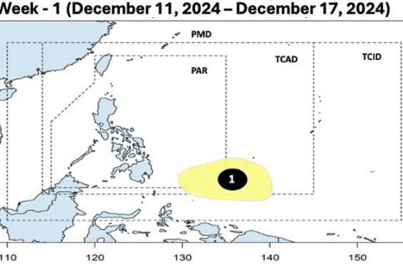
The latest storm and low pressure forecast of the Philippine weather agency PAGASA on December 11 said that a low pressure near the East Sea is forecast to appear in the southern area of the Philippine PAR forecast area and PAGASA's TCAD forecast area during the week from December 11 to 17.
PAGASA typhoon forecasters said the low pressure area has a high potential to strengthen into a low-level typhoon during the forecast period.
However, next week from December 18 to 24, the low pressure near the East Sea is forecast to continue to strengthen, moving towards the area near the Philippines.
As it moves westward, near the eastern part of Mindanao, Visayas, Southern Luzon, the low pressure near the South China Sea is likely to intensify into a storm.
Philippine typhoon forecasters note that the depression has the potential to strengthen into a low to moderate storm.
Therefore, PAGASA does not rule out the possibility that a storm near the East Sea will appear and affect the Philippines during the week from December 18 to 24.

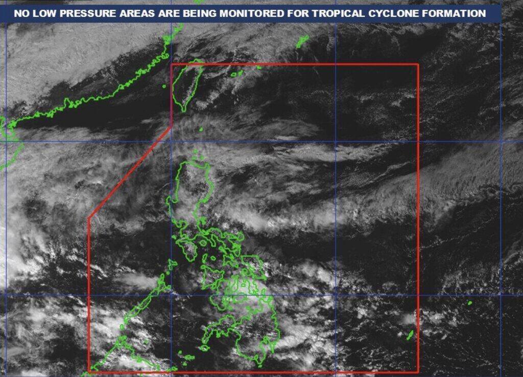
PAGASA's latest storm bulletin on December 11 said that although there will be scattered showers in many places, the Philippines will not record a storm until at least the end of this week.
At least six consecutive storms have entered the Philippine PAR forecast area from late October to November, the most recent of which was Typhoon Pepito (international name Man-yi). If the new storm that forms next week enters the PAR, it will be named Querubin and will be the 17th storm to affect the Philippines this year.
If it forms, it will also be the first storm to be named Querubin, as this is a new storm name that PAGASA has used for the first time for the 2024 typhoon season. In addition to Querubin, other storm names used for the first time in the 2024 typhoon season include Aghon, Romina, and Upang. These are storm names that replace Ambo, Quinta, Rolly, and Ulysses in the Philippines after these names were retired due to causing heavy damage during the 2020 typhoon season.
PAGASA weather expert Benison Estareja said three weather systems including wind shear, easterly winds and northeast monsoon are affecting most parts of the Philippines.
Meanwhile, the northeast monsoon continues to bring cold air to Northern Luzon. Cloudy skies and scattered showers are possible in Cagayan Valley, Apayao, Kalinga, Mountain Province and Ifugao. "Over parts of the Cordillera, Benguet, Abra, Ilocos and the western part of Central Luzon - including Zambales, Bataan, Pampanga and Tarlac - cloudy to cloudy skies with scattered light rains due to the prevailing northeast monsoon," Estareja pointed out.
The easterly winds, or warm air from the east, will affect some areas in the Visayas and Mindanao. "Areas in Eastern Samar, Dinagat Islands, Surigao del Norte and Surigao del Sur may experience rain. Residents should be alert for the risk of flooding and landslides," Estareja added.

Due to wind shear, parts of Central Luzon, Southern Luzon and Metro Manila will experience cloudy skies, scattered rains and localized thunderstorms, according to PAGASA. "There will still be occasional heavy rains due to wind shear or the convergence of warm and cold air," Estareja added.
Weather expert PAGASA noted that the southern areas of Visayas, as well as the southern part of Negros Island and areas affected by the recent Kanlaon volcano eruption, will experience rain on December 11.


