According to the Can Tho City Irrigation Department, the whole city has a coastline of about 72km. In particular, the sea dike from the border of Ca Mau province to Tra Nien canal is about 56km long (formerly in Vinh Chau town, Soc Trang province), the dike surface is 6 - 7.5m wide. This area has about 15,000 households, of which nearly 6,300 households are located along the dyke and river mouth, vulnerable to storms, high tides and coastal erosion. In recent years, from capital for landslide recovery projects, many sections of underground wave-reducing embankments have been built, contributing to the protection of dykes and coastal residential areas.
However, areas that have not yet invested in breakwater are still strongly affected by high tides and big waves, posing a potential risk of serious landslides. Currently, the section from the border of Ca Mau province to culvert No. 4 has completed about 4.2km of underground embankment, and nearly 2.8km has not been implemented. The area from culvert No. 14 to the mouth of My Thanh River has been built with more than 10km of embankment, but there are still about 2.4km that need further investment.
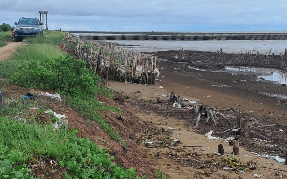
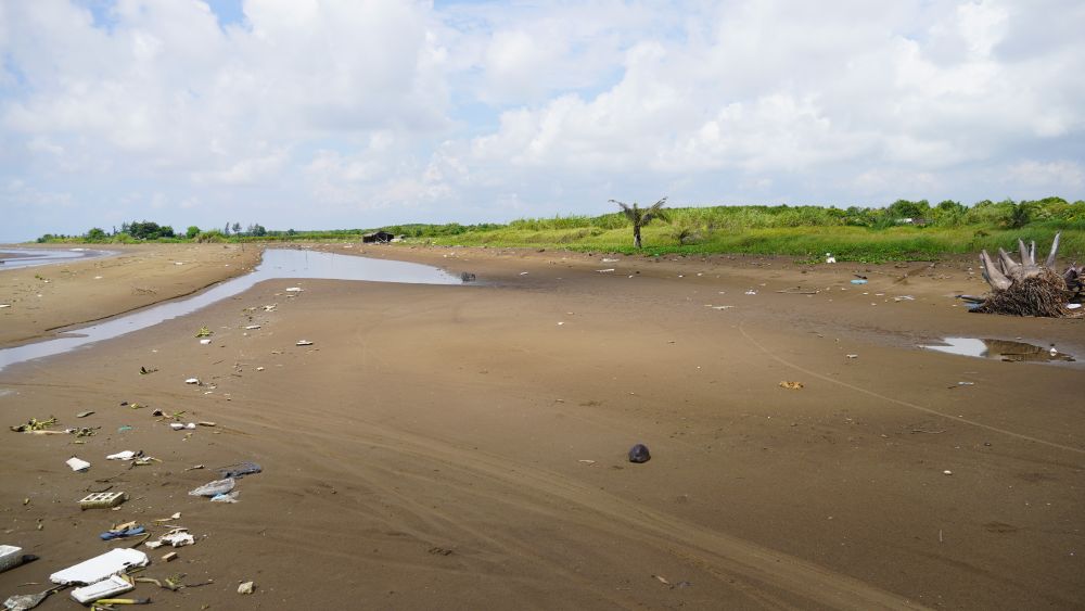
Recorded on the coastline from the mouth of My Thanh River to near culvert No. 14 (Vinh Hai commune) for many years now, there have been serious landslides. During the high tides in early 2023 and late 2024, some sections of the dike here were eroded, affecting production and people's lives.
In the period of 2023 - 2024, thanks to support from the Central Government, the locality has built more than 10km of wave-reducing embankments, helping to protect dykes, regenerate alluvial plains and restore mangrove forests. However, the section from culvert No. 13 to culvert No. 14 has not yet been invested in. During the high tide in early 2025, this area continued to collapse, breaking embankments, flooding people's houses and damaging more than 3 hectares of crops and aquaculture ponds. Currently, there are about 20 households living outside the dike in a state of unsafety, because the area no longer has protective forests and the embankment is weak.
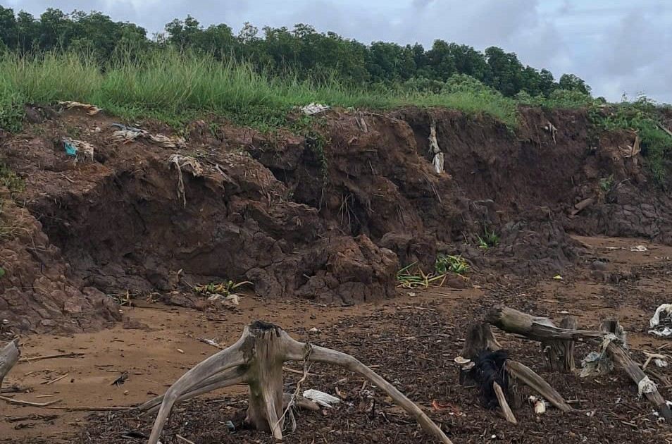
The main causes are identified as the impact of climate change, rising sea levels, high wave pressure and the decline in natural wave-blocking mangrove forests. During the rainy and stormy season, erosion is more complicated, with waves hitting the dike body directly when the protective forest belt is narrowing.
Worryingly, landslides also occur during the dry season, showing that the coastal ecosystem has weakened and is no longer able to recover on its own. People are worried that if the high tide coincides with the time of strong winds, the risk of dike breach is very high, leading to salinity intrusion deep into the fields.
Mr. Thach Ken, a resident of Vinh Hai commune, said: "The windy season is from November to the end of the year, with strong waves, water flooding into the buffer zone for kilometers, severely affecting production. Many households were forced to move to other places".
Mr. Ly Trung Lap, Vice Chairman of Vinh Hai Commune People's Committee (Can Tho City) informed: "The sections with breakwaters have been effective, helping to preserve soil and create conditions for the recovery of mangrove forests. However, there are still about 3km that have not been invested in, the direct waves caused strong erosion, greatly affecting people's lives".
In early October 2025, the Chairman of the People's Committee of Can Tho City issued a decision to declare an emergency situation regarding coastal erosion in the section from culvert No. 13 to culvert No. 14.
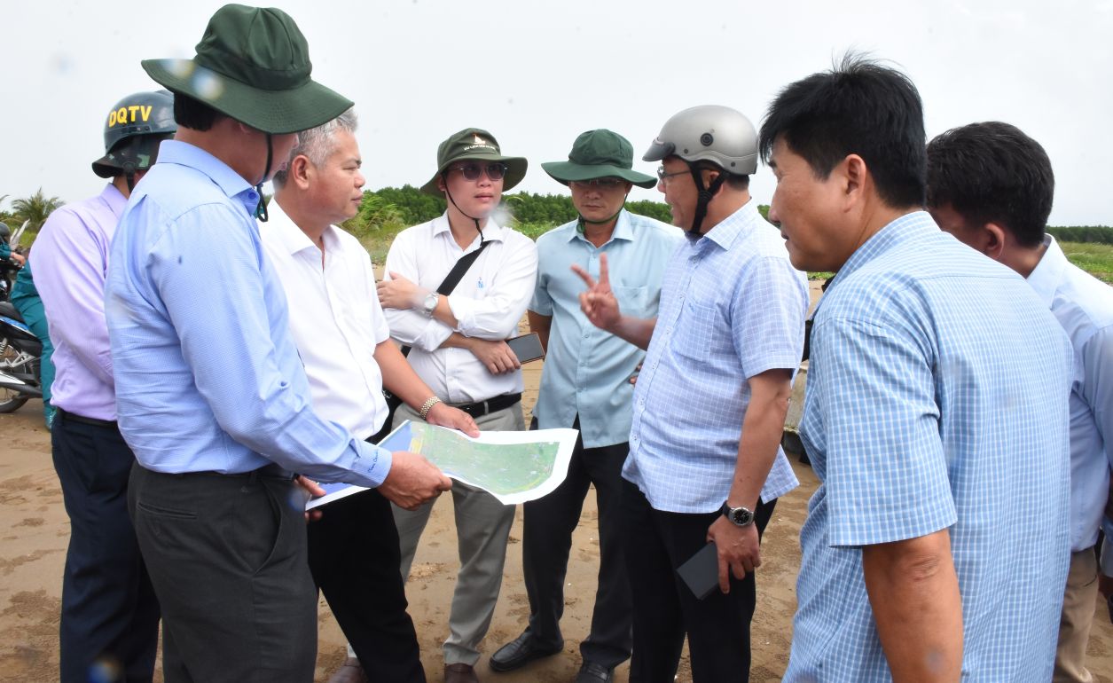
Recently, Vice Chairman of Can Tho City People's Committee Tran Chi Hung directly surveyed the scene, assigned specialized agencies to synthesize reports and propose timely solutions.
Mr. Hung said that investing in wave-reducing embankments is an urgent requirement, to protect the sea dike, restore protective forests and ensure sustainable livelihoods for coastal residents.


