The latest typhoon information from the Philippine Atmospheric, Geophysical and Astronomical Services Administration (PAGASA) on July 23 confirmed that two tropical cyclone systems are operating simultaneously in the Philippine Forecast Area (PAR), causing the risk of heavy rain, strong winds and flash floods from Ilocos Norte to the areas of western Luzon.
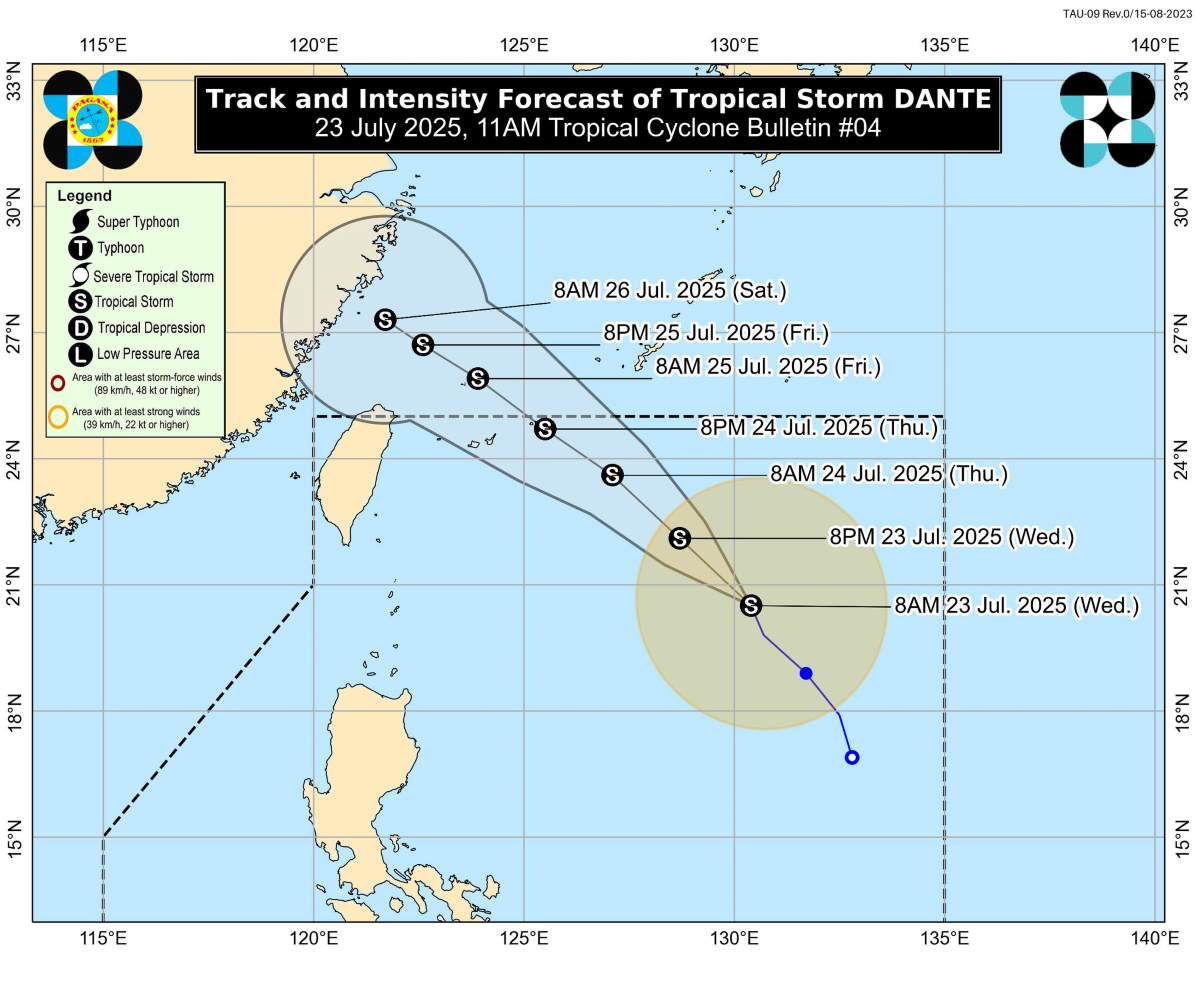
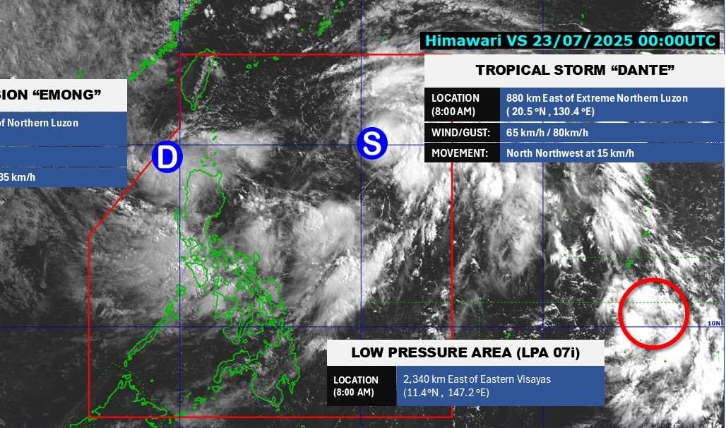
According to Pagasa, tropical depression Dante has increased, becoming a storm Dante (international name is Francisco) on the morning of July 23. At 11h on 23.7, the storm center was about 900 km east of the northernmost pole, the strongest wind near the center of the strong storm 65 km/h, jerking 80 km/h, moving northwest at a speed of 15 km/h to the Ryukyu Islands (Japan) and then to the East China Sea.
Although unlikely to make landfall in the Philippines, the location of Typhoon Dante is triggering the southwest monsoon - causing prolonged rain across Luzon and part of Visayas until at least July 25.
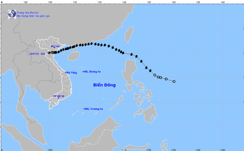
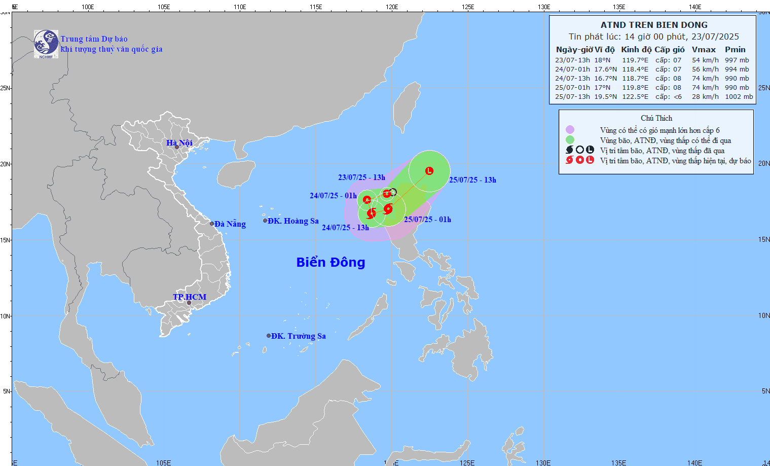
Meanwhile, tropical depression Emong formed from a low pressure area near Northern Luzon on the morning of July 23. At noon of the same day, the tropical depression entered the eastern sea of the North East Sea.
According to the Vietnam National Center for Hydro-Meteorological Forecasting, at 1:00 p.m. on July 23, the center of the tropical depression was at about 18.0 degrees north latitude; 119.7 degrees east longitude, in the eastern sea of the North East Sea. The strongest wind near the center of the tropical depression is level 6-7 (39-61km/h), gusting to level 9; moving west-southwest at a speed of 10-15km/h.
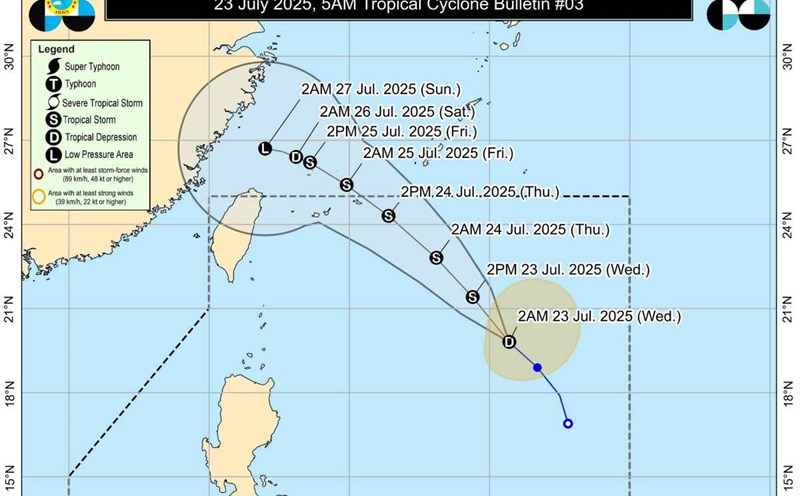
PAGASA weather forecaster Benison Estareja warned that with the current movement, tropical depression Emong could strengthen into a storm in the afternoon or evening of July 24, and did not rule out the possibility of making landfall in the Ilocos region if it slightly deviated to the east.
PAGASA also forecasts that in the next 24 hours, tropical depression Emong combined with storm Dante could create a phenomenon of double-spin interaction, making the weather unpredictable and volatile.
Meanwhile, another low pressure area is also appearing outside the eastern edge of the PAR, more than 2,300km from Eastern Visayas, and is likely to strengthen into a tropical depression or storm in the next 24 hours.
Also on July 23, PAGASA announced a 2-week overview of storm/low pressure forecasts.
Week 1 (from July 23-29): High risk of active storms, with at least 2 storms affecting the PAR area directly, especially Emong and Dante heading towards Taiwan (China) - Ryukyu (Japan) - Border Strait (located between Taiwan, China and the Batan Islands, Philippines, and connecting the Philippine Sea and the East Sea).
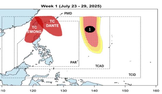
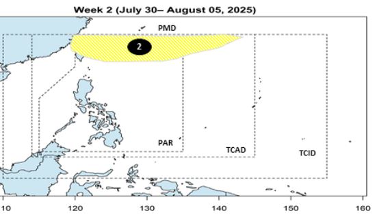
Week 2 (30.7-5.8): Lower chance of storm formation, mainly the remnants of previous week's storms/low pressure.
The Philippines is once again facing the risk of a "double storm" in the rainy season, with potential typhoon Emong making landfall at any time and typhoon Dante quietly bringing with it a monsoon that causes widespread heavy rain.
Typhoon Wipha (Storm No. 3 in the East Sea) made landfall in the Philippines on July 19, causing continuous heavy rain, flooding across the Manila urban area and disrupting people's lives.