At the end of December, the Northwest Pacific and East Sea are forecast to continue to be intertwined with the intertwined effects of many weather systems. La Nina, the northeast monsoon, the tropical convergence zone and the easterly wind can cause increased rainfall, while the possibility of a tropical depression or late storm cannot be ruled out.
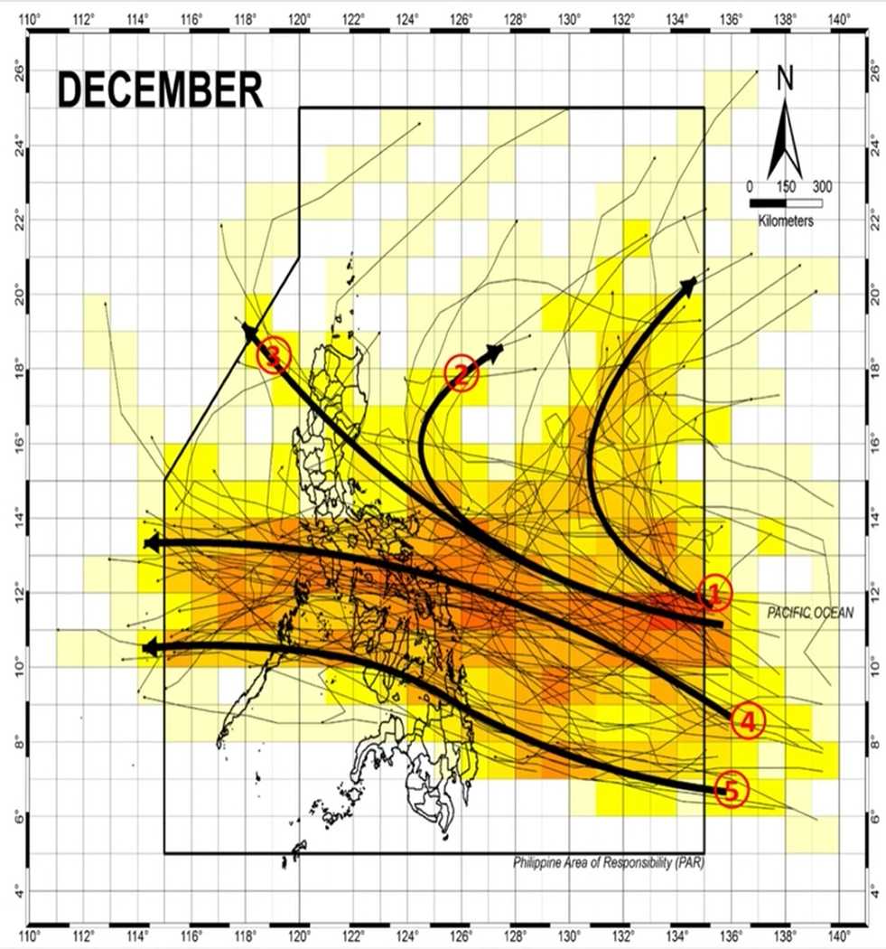
According to the Philippine Atmospheric, Geophysical and Astronomical Services Administration (PAGASA) typhoon forecast, in December, there are usually about 1-2 storms or depressions forming or entering the Philippine Forecast Area (PAR).
This is the average of many years, reflecting the characteristic of the late typhoon season in the Northwest Pacific.
The areas affected mainly in late typhoon scenarios are southern Luzon, Visayas, part of northern Mindanao and the Caraga (Philippines).
For Vietnam, the long-distance circulation of these systems combined with the northeast wind can cause increased rain in the Central, South Central and Central Highlands regions, while the North is mainly affected by cold air.
A notable point in December this year is that rainfall tends to be higher than average, due to the influence of La Nina and the overlap of many weather patterns.
The tropical convergence zone continues to operate, especially in the Visayas and Mindanao regions, causing both rain and " bringing in" disturbances and low pressure. In addition, wind shear - the boundary between hot air masses and cold air - can cause scattered clouds and rain in areas such as central Luzon and Metro Manila; in Vietnam, similar situations often cause persistent rain in the Central region.
Regarding the intensity of the storm and low pressure if they appear, experts say the possibility of strengthening is not high. The reason is that strong northeast winds, carrying cold air and shear, weaken the structure of tropical systems. It is likely that if formed, low pressure or late storms will tend to be weak or only move quickly, with little chance of strengthening as they approach the mainland.
According to the Vietnam National Center for Hydro-Meteorological Forecasting, last night and early this morning (December 17), the area from Quang Tri to Da Nang City and the eastern provinces from Quang Ngai to Dak Lak had rain, showers and thunderstorms in some places.
Forecast for the day and night of December 17, in the area from Quang Tri to Da Nang City, the East of the provinces from Quang Ngai to Dak Lak, there will be rain, moderate rain and thunderstorms with common rainfall from 10-30mm, locally heavy rain over 70mm.
During thunderstorms, there is a possibility of tornadoes, lightning, hail and strong gusts of wind. Localized heavy rains are likely to cause flash floods on small rivers and streams, landslides on steep slopes and flooding in low-lying areas.
Regarding the weather forecast at sea, on the day and night of December 17, the southern East Sea (including Truong Sa special zone) will have scattered showers and thunderstorms. During thunderstorms, there is a possibility of tornadoes and strong gusts of wind.


