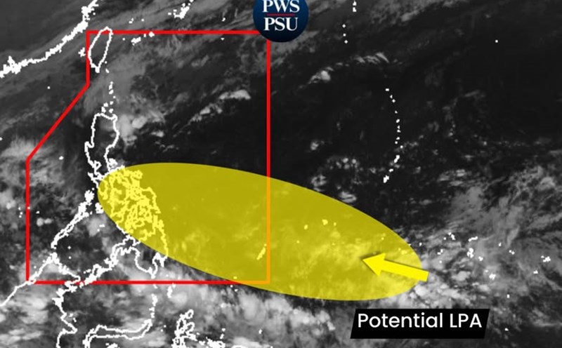
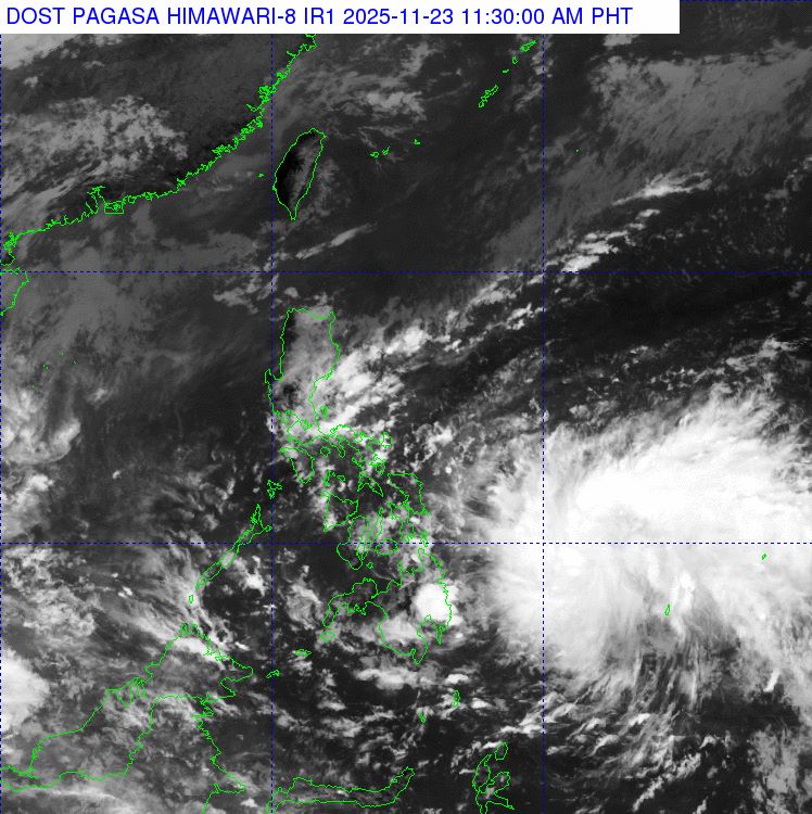
The latest storm information from the Philippine Atmospheric, Geophysical and Astronomical Services Administration (PAGASA) said that at 8:00 a.m. on November 23, the low pressure in eastern Mindanao officially entered the Philippine Forecast Area (PAR) and is likely to develop into storm Verbena. Heavy rain, flash floods and landslides are forecast in many areas in the coming days.
According to PAGASA, the center of the low pressure at 8:00 a.m. on November 23 was at 8.5 degrees north latitude; 134.0 degrees east longitude, 845km east of northeast Mindanao.
The low pressure will be locally named verbena - the name of a flower when it strengthens into a storm. The storm is forecast to make landfall in the Caraga area on the evening of November 24. The storm will then move northwest, passing through Visayas and north of MIMAROPA, then out into the South China Sea on the morning of November 26, becoming the 15th storm.
Storm No. 15 is forecast to move westward to the South Central Coast of Vietnam.
Hurricane Verbena is forecast to bring no strong winds, but will bring heavy rain, with moderate to heavy rainfall on November 24 in Eastern and Central Visayas, Siquijor, and some areas of Caraga, Northern Mindanao.
As the storm passes, more heavy rains may occur in the Visayas, Bicol, CALABARZON and MIMAROPA. The storm could also increase the impact of wind shear, causing prolonged rain in Cagayan Valley and Aurora.
PAGASA warned of flooding and landslides in many places, especially in mountainous and plateau areas, where previous rains could make the situation worse.
Verbena will be the third tropical cyclone in the PAR in November and the 22nd storm of 2025 in the Philippines. Previously, Tino (Storm No. 13 Kalmaegi) and Super Typhoon Uwan (Storm No. 14 Fung-wong) devastated the Central Philippines and Northern Luzon.
PAGASA forecasts that there may be a maximum of 2 storms in the PAR in December. In addition to Hurricane Verbena, the remaining storms in 2025 are Wilma, Yasmin, Zoraida.
The Vietnam National Center for Hydro-Meteorological Forecasting also said that from now until December 20, there is a possibility of 1-2 storms or tropical depressions appearing in the East Sea area, which may affect the mainland of Vietnam.
The weather forecast bulletin of the Vietnam National Center for Hydro-Meteorological Forecasting said that on the day and night of November 24, the northern East Sea (including Hoang Sa special zone) will have strong northeast winds of level 6, sometimes level 7, gusting to level 8-9; from the evening and night, it will strengthen to level 7, gusting to level 9-10, waves 3.0-5.0m high, then increase to 4.0-6.0m, rough seas.
In the afternoon and night of November 24, the Gulf of Tonkin will have northeast winds gradually increasing to level 6, gusting to level 7-8, waves 2.0-4.0m high.
From the evening and night of November 24, the central East Sea area will have strong northeast winds of level 6, sometimes level 7, gusting to level 8-9, waves 3.0-5.0m high, rough seas.
The sea area from southern Quang Tri to Ca Mau and the western sea area of the southern East Sea (including the western part of Truong Sa) will have northeast winds gradually increasing to level 6, sometimes level 7, gusting to level 8-9, waves 2.0-5.0m high, rough seas.