According to the latest storm and low pressure information on the morning of August 2, the low pressure near the East Sea being closely monitored by the Philippine weather agency has strengthened into a tropical depression and left the Philippine Forecast Area (PAR). This system formed on the morning of July 31.
This tropical depression is 1,620 km from Northern Luzon, Philippines with winds of 55 km/h, gusts of 70 km/h and is moving northeast at a speed of 25 km/h.
The latest storm and low pressure forecast on August 1 from the Philippine Atmospheric, Geophysical and Astronomical Services Administration (PAGASA) said that the low pressure near the East Sea is likely to form in the first half of August.
According to Philippine weather forecasters, during the week of August 1 to August 7, a tropical storm will operate in the northern part of the PMD but will not directly affect the Philippines but is expected to head south of Japan.
This is Typhoon Krosa (Storm No. 9 in Japan). The storm has been active for several days in the western Pacific basin.
On the morning of August 2, Typhoon Krosa was 139 km southeast of Narita Airport and had been moving north-northeast at a speed of 17 km/h for the previous 6 hours. The storm will cause waves up to 7.6 m high. Typhoon Krosa is forecast to continue moving east-northeast.
Also during the forecast period from August 1 to August 7, a low pressure near the East Sea is likely to appear at the eastern boundary of PAGASA's PMD forecast area with little chance of strengthening into a storm or tropical depression.
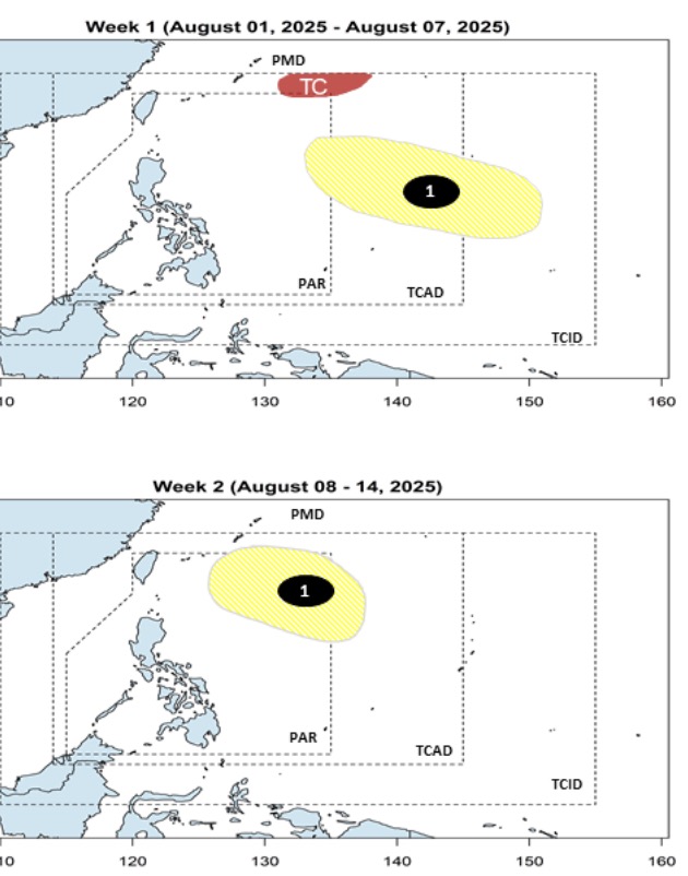
The bulletin also said that the low pressure near the East Sea that formed last week is forecast to continue to operate during the week of August 8 to August 14, moving gradually westward into the Philippine Forecast Area (PAR). This low pressure continues to have little chance of strengthening into a storm or tropical depression.
Typically, two to three typhoons form or enter the PAR in August. The next typhoons in the Philippines are Fabian, Gorio and Huaning.
According to PAGASA, storms and tropical depressions in August near the East Sea often have four main paths: First, the system goes north of the PAR but does not make landfall in the Philippines but heads towards Japan. Even if it does not make landfall, storms or tropical depressions are still likely to intensify the southwest monsoon, thereby affecting the weather in the Philippines.
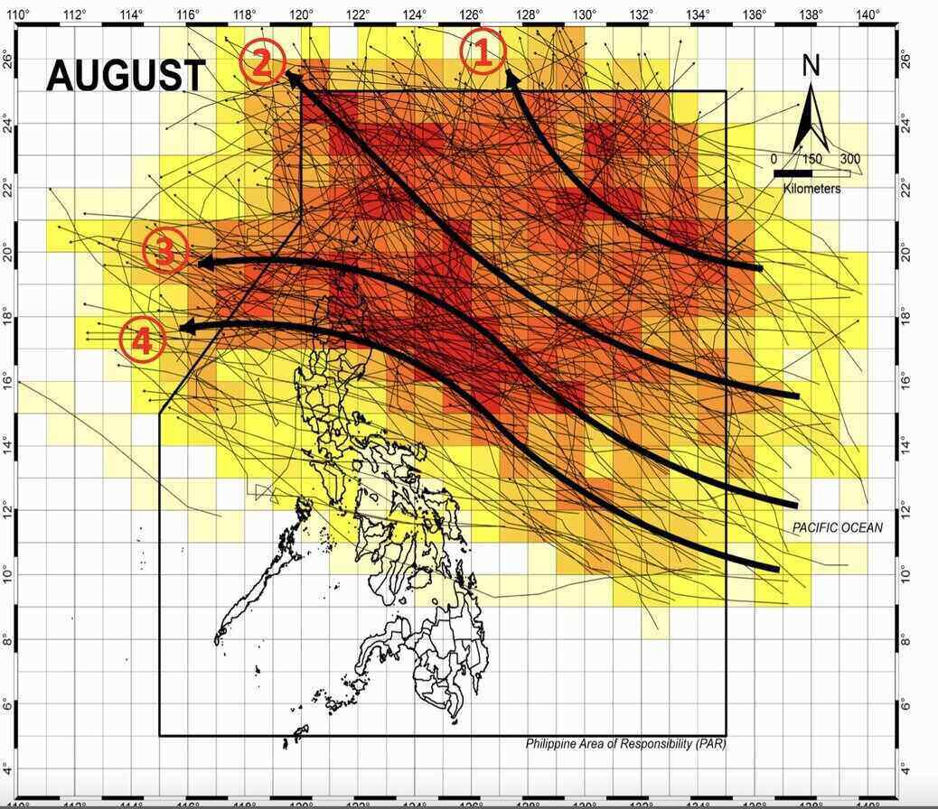
Second, the storm or tropical depression will circulate through the northwest of the PAR, towards Taiwan (China) and affect the activities of the southwest monsoon in the Philippines.
Third, storms or tropical depressions make landfall in the Philippines, in the northern islands of the country, then enter the East Sea and head towards Hong Kong (China) or Vietnam.
Fourth, storms or tropical depressions pass through the central or southern part of Luzon Island, Philippines before entering the East Sea and heading towards Vietnam.