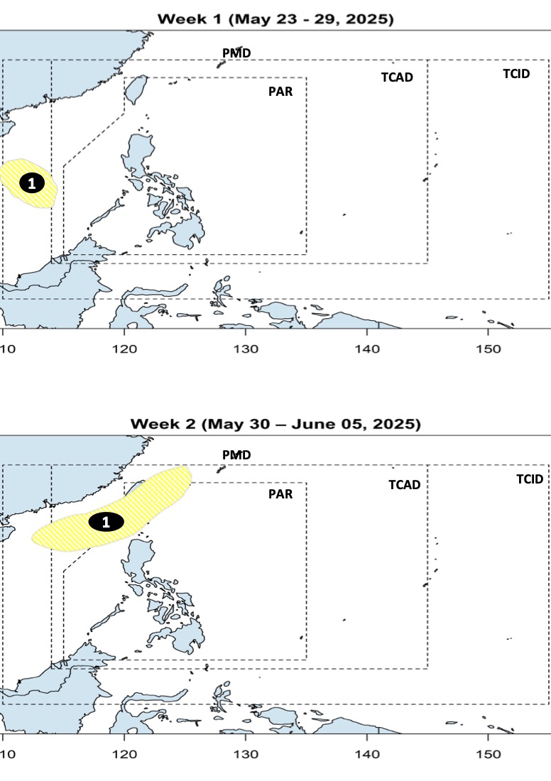
The latest storm and low pressure information from the Philippine Atmospheric, Geophysical and Astronomical Services Administration on May 23 predicts that the low pressure in the East Sea will appear during the week from May 23 to May 29.
The low pressure is forecast to form westward within PAGASA's PMD forecast area. Philippine weather experts say the low pressure has little chance of strengthening into a storm during the week of May 23 to 29.
According to PAGASA's forecast, during the week of May 30 to June 5, the low pressure in the East Sea is expected to continue moving in the PMD forecast area, still unlikely to strengthen into a storm. However, during this time, the low pressure in the East Sea may move northeast, towards the Ba Si - Balintang Strait.
PAGASA said on May 22 that no tropical storms will form or enter the Philippine Forecast Area (PAR) until the end of May. PAGASA weather expert Benison Estareja said that current models do not see any low pressure or storms recorded within the monitoring area. However, Mindanao and the Philippines are forecast to continue to experience heavy rain due to the influence of the tropical convergence zone.
On May 23, PAGASA said that the tropical convergence zone will continue to bring showers to Mindanao. PAGASA weather expert Grace Castaneda warned that heavy rains are possible in most parts of Mindanao, especially in the Zamboanga peninsula, Bangsamoro in Indonesia, Soccsksargen and Davao region.
Based on our latest analysis, this rain will continue for the next few days. Therefore, we recommend that people in the Mindanao area be more cautious as there is still a risk of flooding or landslides, said Castaneda.
Ms. Castaneda also emphasized that there are currently no storms or low pressure areas being monitored within or outside the Philippine PAR forecast area.