Latest storm news

Typhoon Ba Vi is strong at level 14, the latest forecast is the time and area where the storm is about to make landfall
|
It is forecasted that around the night of July 11th to the morning of July 12th, Typhoon Ba Vi will make landfall in the area between Fujian and Zhejiang provinces of China.

Bad weather forecast from tonight in the East Sea due to the impact of Super Typhoon Ba Vi
|
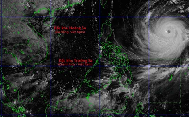
The meteorological agency warns of strong winds and large waves in many sea areas of the East Sea due to the impact of super typhoon Ba Vi (international name Bavi).

China activates emergency storm and flood response in Zhejiang and Fujian
|
Coastal provinces in eastern China simultaneously strengthened response measures as Typhoon Ba Vi, storm number 9 of this year, approaches the mainland.

Super typhoon Ba Vi will still be very strong in the next 24 hours, forecast of storm landfall time and area
|
Super typhoon Ba Vi (international name Bavi) is forecast to maintain super typhoon level in the next 24 hours and is likely to make landfall in Fujian (China) in the afternoon and night of July 11.

Super typhoon Ba Vi maintains maximum intensity for more than 4 days, the strongest in decades
|
Super typhoon Ba Vi (Bavi) - one of the strongest super typhoons in decades in the northwest Pacific began to weaken.
Super typhoon Ba Vi still has gusts above level 17, forecast time and area of storm landfall
|
It is forecasted that around the night of July 11 - early morning of July 12, super typhoon Ba Vi (international name is Typhoon Bavi) will make landfall in the Fujian area (China).

China warns of July storm peak, risk of Ba Vi going deep inland
|
China forecasts more storms than the average in July, with the number of storms making landfall or affecting coastal areas higher than in previous years.

Super typhoon Ba Vi will be very strong in the next 2-3 days, forecast time and area of storm landfall
|
It is forecasted that around July 12, Typhoon Ba Vi (international name is Typhoon Bavi) will make landfall in the Fujian area (China), then go deep inland and gradually weaken.

Super typhoon Ba Vi maintains intensity for 78 consecutive hours, heading towards the next landfall area
|
Super typhoon Ba Vi is forecast to pass through northeastern Taiwan (China) and then make landfall in eastern China.

Super typhoon Ba Vi gusts above level 17, forecast risk affecting the East Sea
|
This morning, July 6th, Super Typhoon Ba Vi is strong at level 17, gusting above level 17; it is forecast that there is no sign of entering the East Sea but it will still cause strong winds this weekend.

Super typhoon Ba Vi may affect the East Sea area, forecast path
|
Super typhoon Ba Vi is moving in a Northwest direction, showing no signs of entering the East Sea but is likely to cause strong winds throughout the East Sea in the coming weekend.

Super typhoon Ba Vi extremely strong enters US territory, waves more than 10m high
|
The latest storm news from AFP said that Guam territory and the US Northern Mariana Islands are urgently preparing before Super Typhoon Ba Vi sweeps through the area.

Storm No. 1 gusting at level 10 is moving very slowly, continuing to cause heavy rain
|
Typhoon No. 1 is still maintaining intensity level 8, gusting level 10 in the southern area of Guangxi province (China), 120km north-northeast of Mong Cai (Quang Ninh).

Super typhoon Ba Vi accelerates northwest, expanding its scope of impact
|
Super typhoon Ba Vi (Bavi) has been downgraded from super typhoon level 5 to super typhoon level 4, but forecasters believe this is just a temporary weakening process.

Storm No. 1 has moved to China but still causes heavy rain, dangerous weather
|
Typhoon No. 1 has entered southern Guangxi province (China), but the typhoon's circulation continues to cause dangerous weather in the Northeast region.