Latest storm news
The world's strongest super typhoon Sinlaku intensifies rapidly, El Nino ignites disaster
|
Super typhoon Sinlaku surged from level 1 to level 5 in just 30 hours, devastating the US island and raising concerns about an extreme storm season due to El Nino.
Warning of the strongest El Nino in 140 years threatens to disrupt the 2026 storm season
|
Extremely strong El Nino - possibly in the strongest group in 140 years - is raising concerns about the disruption of storm paths in 2026.
Forecast of cold air causing thunderstorms in the North, ending hot weather
|
It is forecasted that cold air compressing a low pressure trough will cause rain in the North and Thanh Hoa from the night of April 16, the temperature will drop rapidly.
Forecast of cold air trend, developments of rain and hot sun in the coming month
|
Forecast for the next month, it is likely that there will still be weak cold air and low pressure trough compressions, which may cause dangerous thunderstorms.
Extremely dangerous super typhoon threatens US territory
|
Super typhoon Sinlaku, assessed as extremely dangerous, is heading towards the Northern Mariana Islands, USA.
The world's strongest super typhoon Sinlaku is about to make landfall, high risk of disaster
|
Super typhoon Sinlaku - the strongest storm on the planet this year - is approaching US islands in the Western Pacific.
Super typhoon Sinlaku is the strongest in the world since the beginning of 2026
|
Tonight, April 12, Sinlaku has reached super typhoon level and is one of the 3 strongest storms in April since 1977.
World 24h: Typhoon Sinlaku changes direction, rapidly intensifies
|
World News 12. 4: US wants to train gamers to become air traffic controllers; Typhoon Sinlaku changes direction, rapidly intensifies...
Forecast risk of Typhoon Sinlaku to strengthen into the first super typhoon in 2026
|
Typhoon Sinlaku may strengthen to super typhoon level. This will be the first super typhoon in the Northwest Pacific in the 2026 typhoon season and will not move into the East Sea.
Typhoon Sinlaku may become a super typhoon, winds up to 241 km/h
|
Typhoon Sinlaku may reach super typhoon level as it approaches the Mariana Islands.
Typhoon Sinlaku changes direction, rapidly intensifies and is threatening the first mainland area
|
Typhoon Sinlaku may strengthen to level 4 as it approaches Guam, with a risk of heavy rain, floods and gusts of wind.
Typhoon Sinlaku causes dangerous rain and wind for 60 consecutive hours, severely affected area gradually revealed
|
It is forecast that Typhoon Sinlaku may strengthen into a major typhoon, leading to extreme rain, strong gusts of wind and the risk of continuous flash floods from 48-60 hours.
Forecast of the risk of very strong storms in 2026
|
In 2026, the ENSO phase transition - atmosphere - ocean conditions are forecast to be unstable, which may be the cause of very strong storms.
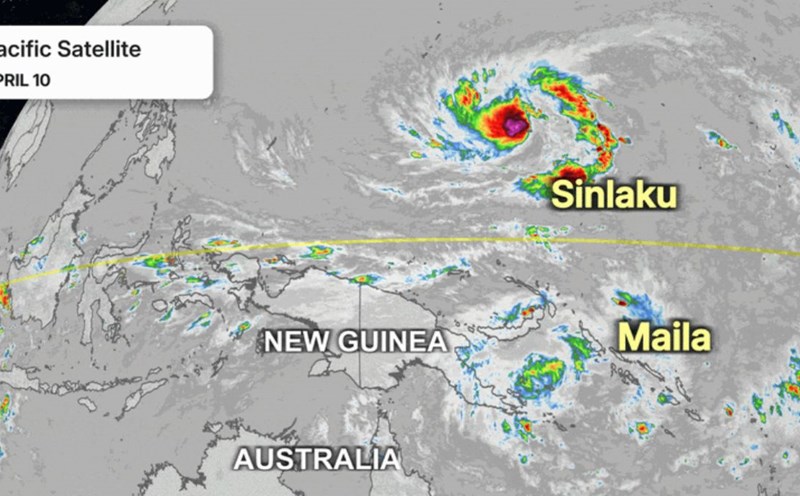
Unusual double storm in the Pacific Ocean, East Sea under new pressure
|
The double typhoon operating simultaneously in the two Pacific hemispheres has led to widespread weather fluctuations, including the East Sea.
World 24h: Sinlaku may become the strongest storm at the beginning of the season
|
World news 10. 4: Russian steel exports accelerate, approaching records; Sinlaku may become the strongest storm at the beginning of the season...


