Low pressure forecast
New low pressure appears, super typhoon forecast near the East Sea in November
|
The newly formed low pressure is forecast to have little chance of strengthening into a tropical depression in the next 24 hours.
Low pressure officially enters the East Sea, heavy thunderstorms
|
The low pressure in the East Sea is causing severe thunderstorms.
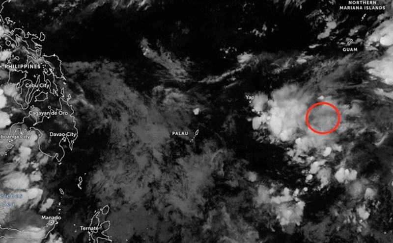
Newly formed low pressure is about to enter the East Sea
|
A newly formed low pressure is forecast to pass through the mainland of the Philippines, entering the East Sea.
Tropical depression officially enters the East Sea, forecast to be strongly affected
|
It is forecasted that at noon on October 23, the tropical depression will enter the eastern sea area of the North East Sea.
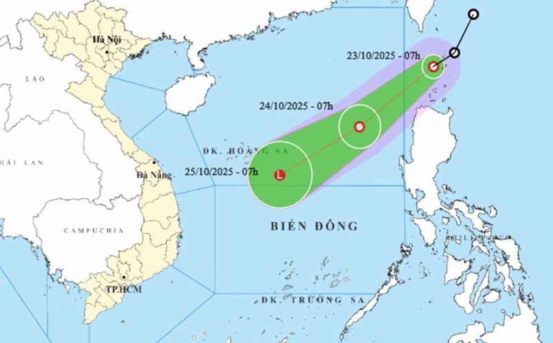
New tropical depression enters the East Sea right after storm No. 12
|
While storm No. 12 Fengshen weakens when it hits Da Nang, a new tropical depression will enter the East Sea today, October 23.

New low pressure forecast near the East Sea will become a storm right after storm No. 12
|
The new low pressure is likely to strengthen into storm Salome near the East Sea when storm No. 12 Fengshen weakens. Weather forecast for heavy rain.
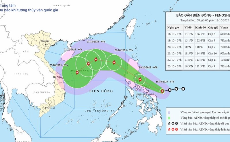
Typhoon Fengshen will make landfall in the next 24 hours, intensifying violently when entering the East Sea
|
The tropical depression near the East Sea will strengthen into storm Fengshen. The storm is forecast to enter the East Sea as storm No. 12 after making landfall in the Philippines.
Tropical depression is about to strengthen into a storm approaching the East Sea
|
The tropical depression near the East Sea is forecast to strengthen into a storm in the next 24 hours.

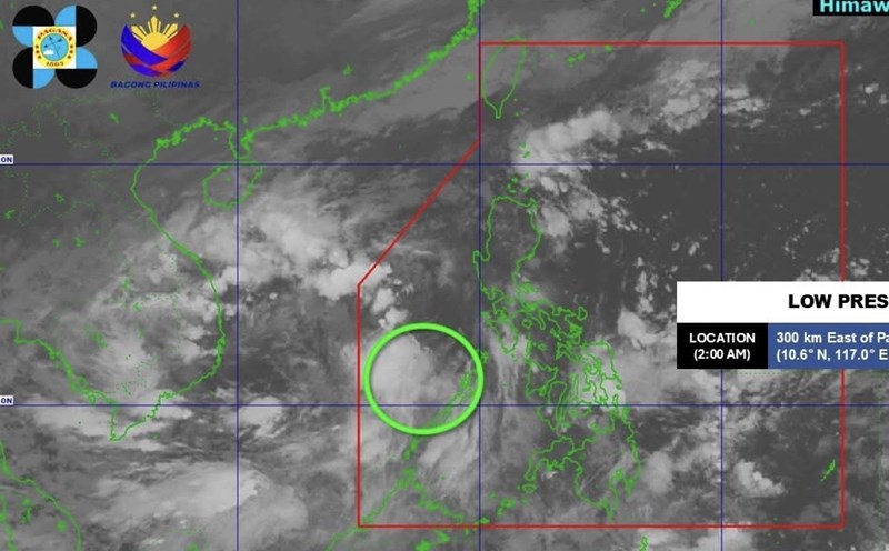
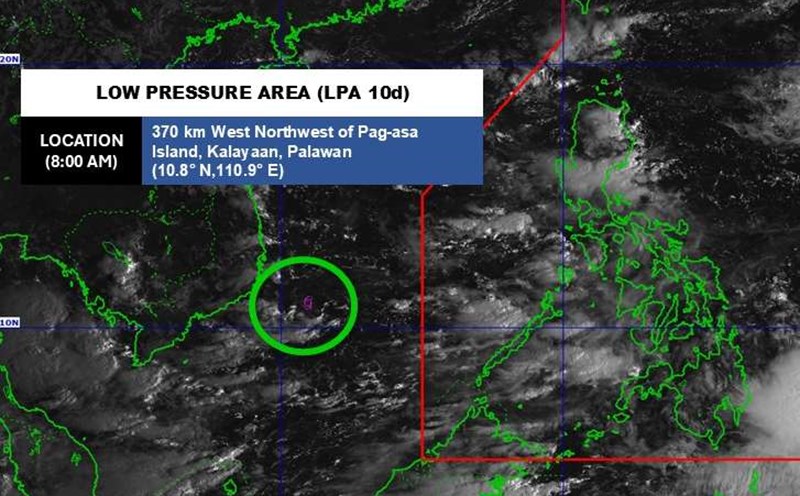
New low pressure connects low pressure near the East Sea, storm No. 12 is about to appear
|
The new low pressure near the South China Sea approaches the northern mainland of the Philippines, while another low pressure is strengthening near the Philippine area of responsibility.

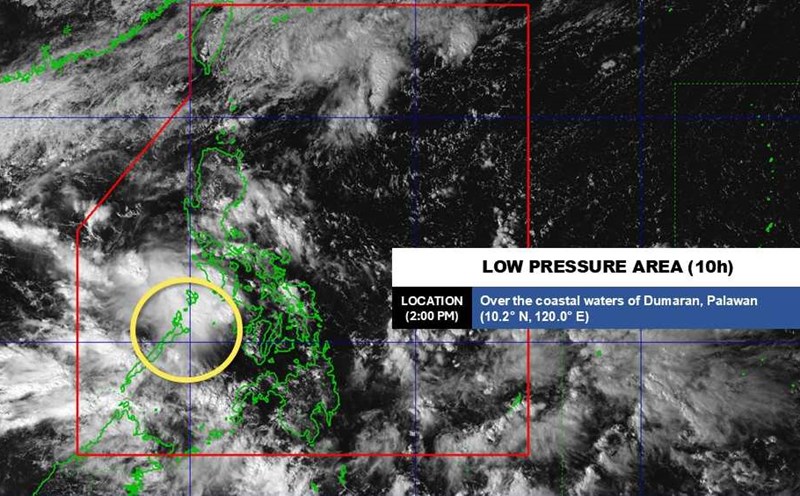
New low pressure near the East Sea is likely to strengthen
|
The new low pressure has formed near the East Sea, and is likely to strengthen into a tropical depression.

Typhoon Nakri is about to become a typhoon, strong winds may overturn vehicles
|
Typhoon Nakri is moving east-northeast at a speed of about 31 km/h off the coast of Japan. The sea was rough, with the highest waves recorded at up to 7.9 m.
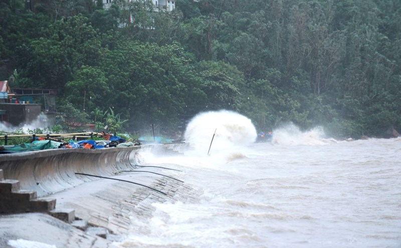
New low pressure approaches the mainland of the South Central region, heavy thunderstorms
|
A low pressure is forecast in the East Sea and has entered the sea areas of Lam Dong and Khanh Hoa provinces of our country.

Storm Halong is extremely strong as it approaches land, with strong winds of 252 km/h
|
Typhoon Halong is forecast to approach the mainland of the Izu island chain in southern Tokyo (Japan), with strong gusts of wind, strong waves and scattered showers.

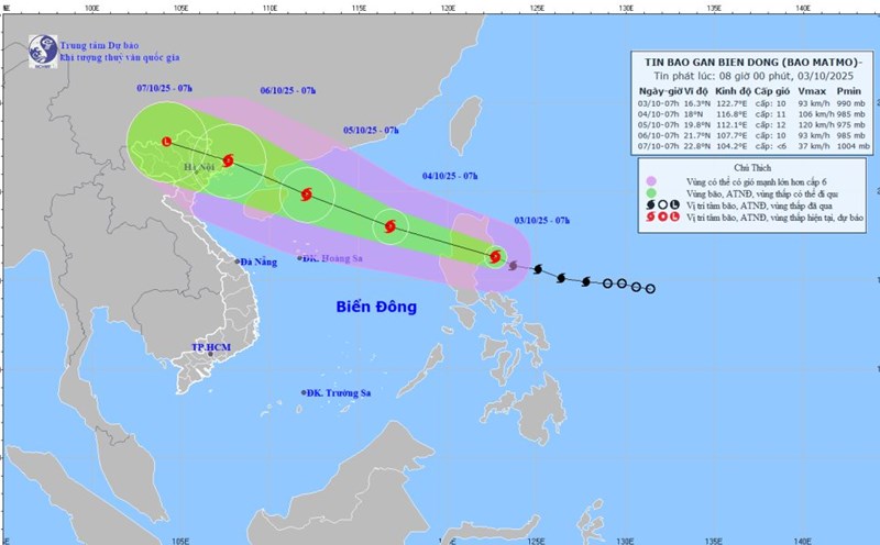
New tropical depression appears right after storm No. 11 Matmo
|
The tropical depression has just formed right after storm No. 11 Matmo dissipated, and is forecast to strengthen.
Storm No. 11 Matmo officially made landfall, wind gusts of 180km/h
|
Typhoon No. 11 Matmo has officially made landfall in the Philippines, accelerating into the East Sea today.