Low pressure
Storm Fernand forecast to strengthen into a hurricane today
|
Fernand has formed in the Atlantic, southeast of Bermuda, since August 23.
Forecast of the most affected area of the low pressure right after storm No. 5 Kajiki
|
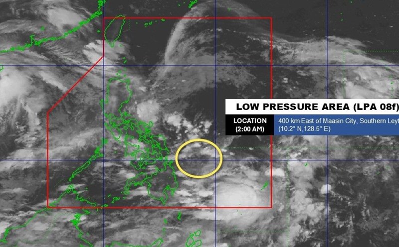
A new low pressure has emerged right after storm No. 5 Kajiki in the East Sea - which was gusting to level 17 on the morning of August 25.

Forecast of the next storm Jacinto right after storm No. 5 in the East Sea
|
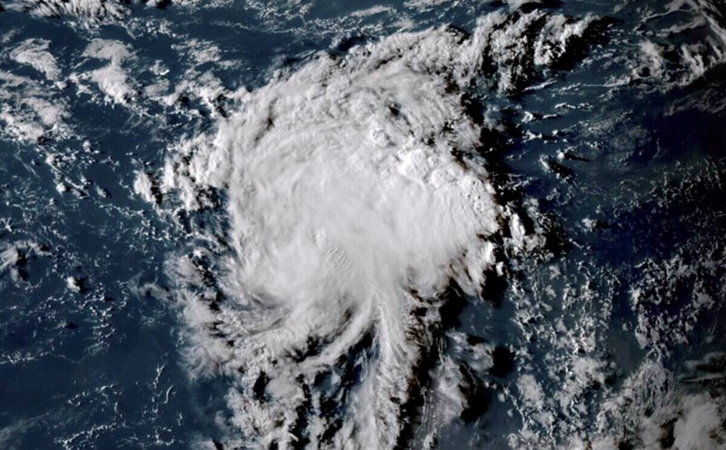
A low pressure area near the Philippines is being closely monitored as it is likely to become the next storm No. 5 Jacinto in the East Sea.

Low pressure forecast to follow storm No. 5 Kajiki into the East Sea
|
A new low pressure is forecast to enter the East Sea right after storm No. 5 Kajiki moves towards Vietnam.

Storm triangle forms, 3 new depressions follow storm Erin
|
Forecasters are monitoring three depressions that could become tropical storms in the coming days following Erin in the Atlantic.

Tropical depression near the East Sea is about to intensify into storm No. 5, heading straight to the Central region
|
Tropical depression Isang made landfall in the Philippines on the morning of August 22, expected to strengthen into storm No. 5 in the East Sea tomorrow, August 23.

Low pressure near the East Sea strengthens into tropical depression Isang
|
The low pressure near the East Sea located inside the Philippine PAR forecast area has strengthened into a tropical depression at 8:00 a.m. on August 22.

Forecast of storm No. 5 in the East Sea as complicated, wide-ranging area of impact
|
The low pressure in the Philippines is forecast to strengthen into a tropical depression today, then become the fifth storm in the East Sea with complex developments and intensity.

New storm forecast to follow as Erin is about to get stronger
|
Hurricane Erin is forecast to strengthen into a Category 3 hurricane while the risk of a new storm forming in the Atlantic is up to 70%.

Forecast of the most affected area when tropical depression enters the East Sea this weekend
|
The low pressure area in the Philippines is likely to strengthen into a tropical depression, even a storm, and enter the East Sea this weekend.

Forecast of when a new low pressure will enter the East Sea
|
When entering the East Sea, it is expected that this weekend, the low pressure is likely to strengthen into a tropical depression.

Forecast of low pressure connecting low pressure around the East Sea
|
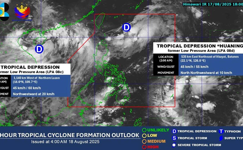
Forecast of 3 low pressure areas around the East Sea after the tropical depression on land affecting the weather in Vietnam and tropical depression Huaning.

The tropical depression in the East Sea has just made landfall, and a new low pressure has appeared
|
Early in the morning of August 19, a tropical depression in the East Sea entered the mainland areas of Quang Ninh - Hai Phong provinces, while a new low pressure appeared near the Philippines.

Forecast of the time when the tropical depression near the East Sea will strengthen into a storm
|
The tropical depression near the East Sea, called Huaning by the Philippine weather agency, is forecast to strengthen into a storm.
More Huaning low pressure as the tropical depression of the East Sea is heading towards the Gulf of Tonkin
|
While the tropical depression in the East Sea is moving towards the Gulf of Tonkin, a new depression has strengthened into tropical depression Huaning.