Low pressure
Hurricane Paolo forecast after storm No. 10 Bualoi in early October
|
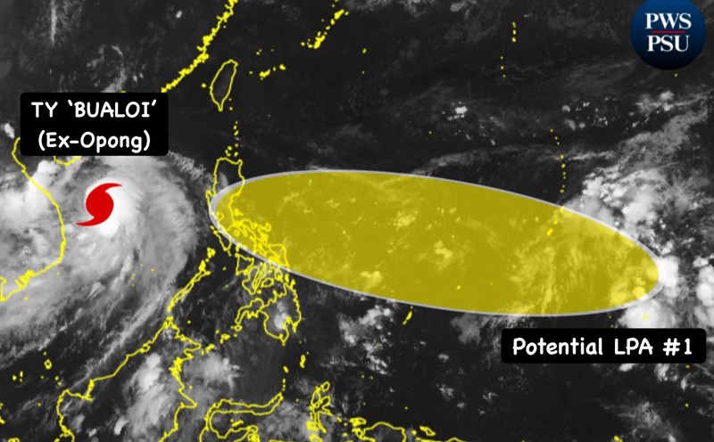
As soon as Typhoon No. 10 Bualoi left the Philippines, a new disturbance area appeared that could strengthen into Typhoon Paolo.

New low pressure forecast to appear right after super typhoon Ragasa
|
A new low pressure is forecast to form near the East Sea right after Typhoon No. 8 Mitag and Typhoon No. 9 Ragasa.

Storm No. 8 in the East Sea forms, potential super typhoon No. 9 is accelerating
|
Typhoon No. 8 in the East Sea, international name Mitag, formed at noon on September 18.
Storm No. 8 in the East Sea has not yet ended, storm No. 9 is weak, could become a super typhoon
|
Tropical depression Mirasol has entered the East Sea, expected to strengthen into storm No. 8, while tropical depression Nando may strengthen into storm No. 9.
Another low pressure near the East Sea intensifies, forecast to become a strong storm
|
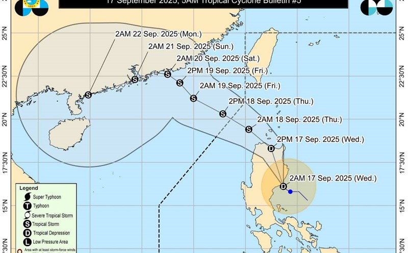
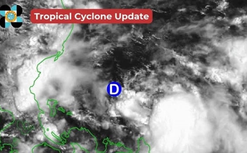
On the morning of September 17, the low pressure area near the East Sea in the southeast of the Philippines strengthened into a tropical depression and is likely to become a storm in the coming days.
Low pressure near the East Sea strengthens into tropical depression
|
According to the latest storm news, on the afternoon of September 16, the low pressure near the East Sea in the East of Luzon Island (Philippines) strengthened into a tropical depression.

Forecast of the path of the low pressure area about to strengthen in the next 24 hours
|
According to the meteorological agency, in the next 24 hours, the low pressure area is forecast to move west-northwest and is likely to strengthen into a tropical depression.
La Nina is about to hit, warning of heavy rain, storm after storm
|
La Nina could appear as early as October, bringing heavy rain, strong storms and the risk of widespread flash floods and landslides.
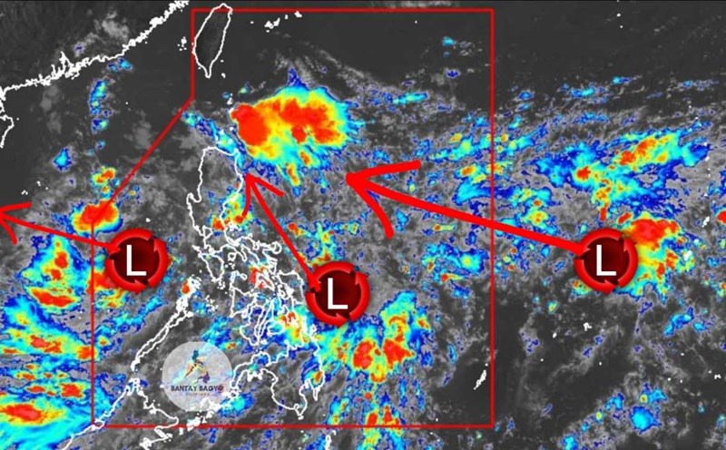
Low pressure surrounds the East Sea, rapidly strengthening, affecting Vietnam
|
According to the latest storm/low pressure information, there are currently 3 low pressure areas, disturbances in the East Sea and Northwest Pacific, with the risk of affecting Vietnam.
Low pressure connects low pressure into the East Sea, forecast to head straight towards Vietnam
|
Low pressure continuously forms, at risk of becoming a storm in the East Sea and heading straight towards Vietnam.

The old low pressure in the East Sea has not dissipated, a new low pressure has appeared, heading towards Vietnam
|
On the afternoon of September 15, the East Sea and the Philippines simultaneously recorded two low pressure areas, causing bad weather, with the risk of increased heavy rain in many places.

Storm Gabrielle awaits to explode, 2 low pressure areas follow this week
|
The seas are entering the peak of the 2025 storm season, as storm Gabrielle is waiting to form with two other disturbances that could strengthen into low pressure.
New low pressure area appears in the East Sea, bad weather forecast
|
According to the meteorological agency, the new low pressure area has affected the weather in the central and southern East Sea (including the sea area east of Truong Sa).
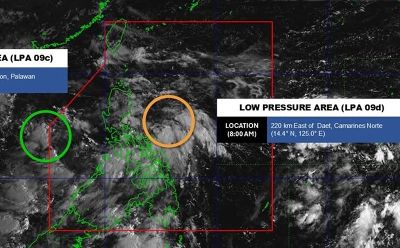
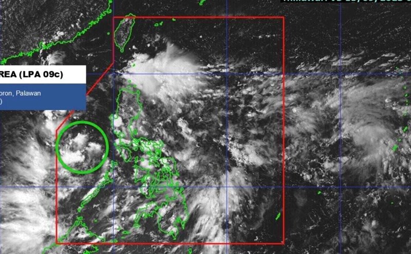
Low pressure enters the East Sea, forecast heavy rain in many areas
|
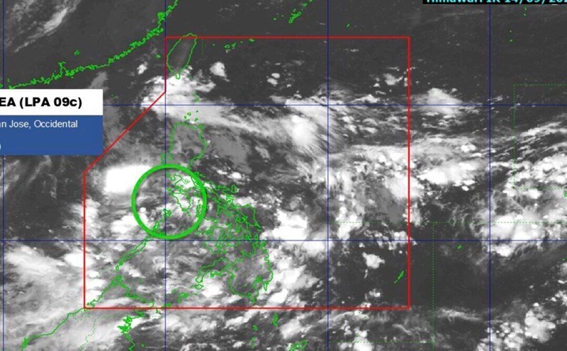
Low pressure 09c has entered the East Sea, currently 215km west of San Joe, Occidental Mindoro, Philippines.
Low pressure strengthens, storm risk near land this week
|
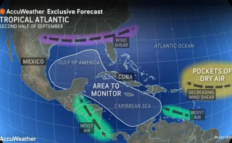
A low pressure area under the reach of the US National Hurricane Center (NHC) is likely to strengthen, even becoming a storm this week.