Low pressure near the East Sea

The old low pressure in the East Sea has not dissipated, a new low pressure has appeared, heading towards Vietnam
|
On the afternoon of September 15, the East Sea and the Philippines simultaneously recorded two low pressure areas, causing bad weather, with the risk of increased heavy rain in many places.

Storm Gabrielle awaits to explode, 2 low pressure areas follow this week
|
The seas are entering the peak of the 2025 storm season, as storm Gabrielle is waiting to form with two other disturbances that could strengthen into low pressure.
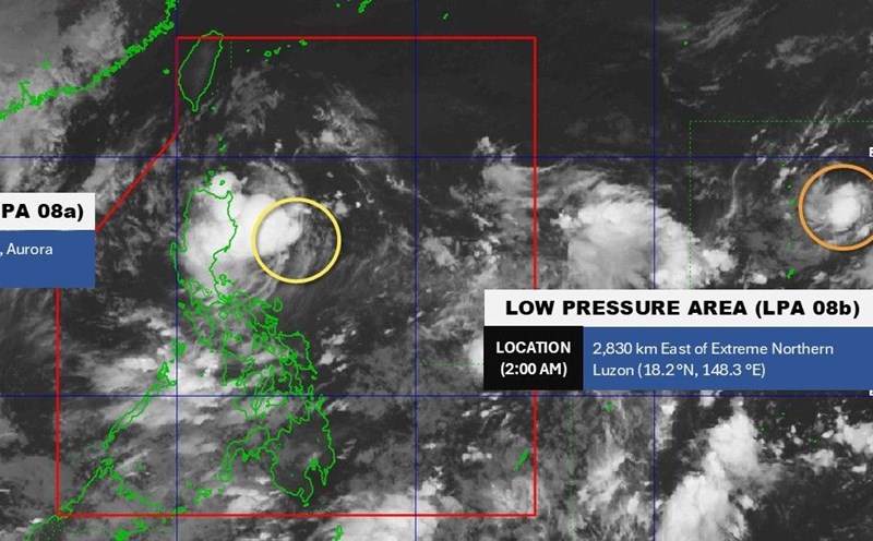
Notable developments of the low pressure near the East Sea
|
The low pressure near the East Sea is unlikely to become a tropical depression in the next 24 hours.
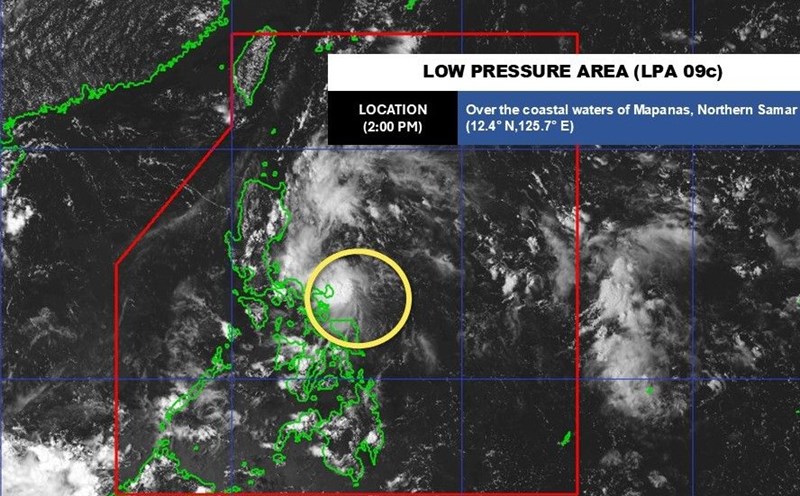
Warning of many areas affected by low pressure near the East Sea
|
The low pressure area near the East Sea in the Philippines affects many areas; heavy rain, flooding and landslides are forecast.
Storm Mirasol forecast in the East Sea, risk of exploding many new storms
|
The next storm forecast for the South China Sea is Mirasol, while two other storms are expected to appear in the Pacific and Atlantic.
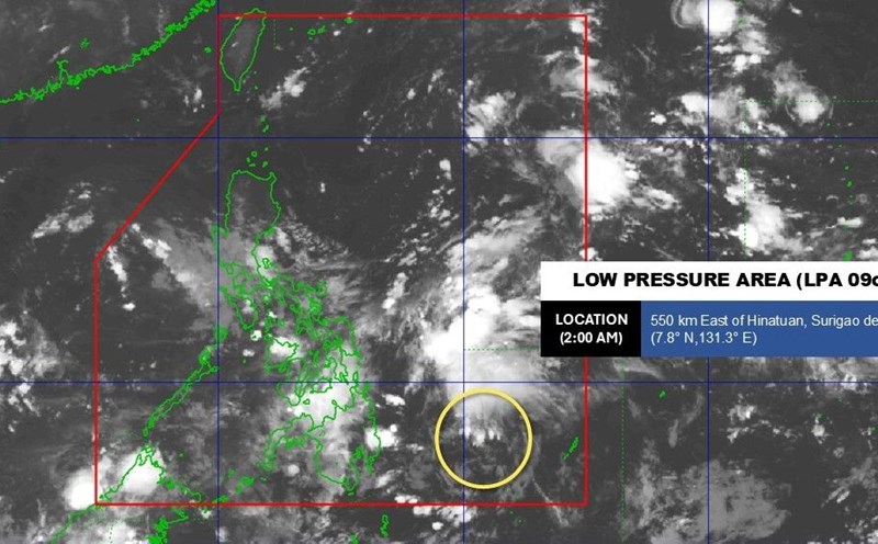
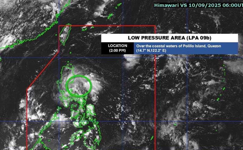
Forecast of when the low pressure will strengthen, enter the East Sea and affect Vietnam
|
The low pressure near the Philippines is forecast to strengthen into a tropical depression by the end of the week and may move into the East Sea in the next few days.
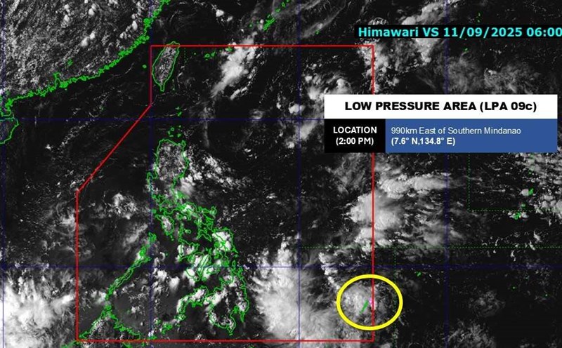
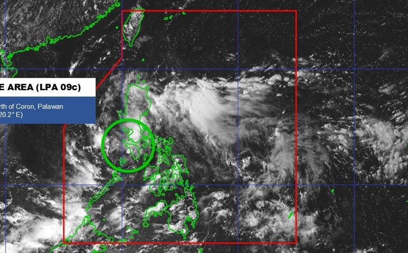
Forecast of the possibility of low pressure near the Philippines strengthening, entering the East Sea
|
A new low pressure area has appeared in the Philippines since the afternoon of September 11, likely entering the East Sea.
New low pressure forecast to enter the East Sea, may become storm No. 8 and head towards Vietnam
|
The new low pressure is forecast to enter the East Sea, head towards Vietnam and is likely to strengthen into storm No. 8 in the East Sea.

Low pressure/storm forecast near the East Sea until the end of the week
|
September is usually the peak of the typhoon season with 2-3 depressions or storms that may appear in the East Sea and the Northwest Pacific.

Low pressure forecast near the East Sea after storm No. 7
|
According to the latest storm/low pressure forecast, 3 low pressure areas are expected to appear near the East Sea in the next 2 weeks, after storm No. 7.
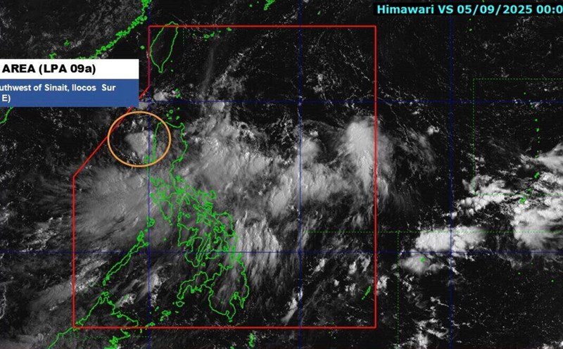
New low pressure appears in the East Sea, forecast to strengthen soon
|
The low pressure in the East Sea has just appeared on the morning of September 5 and is forecast to quickly become a tropical depression.
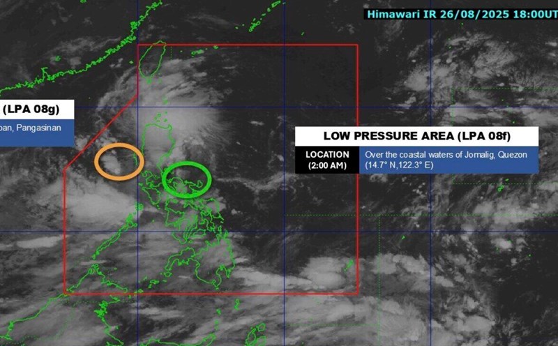
New low pressure near the East Sea has not dissipated yet
|
The low pressure near the East Sea that formed a few days ago continues to operate while a low pressure in the East Sea has just formed on the morning of August 27.

Forecast of 4 consecutive low pressure areas around the East Sea after storm Podul
|
It is forecasted that right after Typhoon Podul, there will be 4 consecutive low pressure areas appearing around the East Sea, including 2 low pressure areas in the East Sea.

Typhoon Podul gusts to level 13, new low pressure accumulates to threaten the East Sea
|
According to the latest storm news, on the morning of August 12, Typhoon Podul strengthened into a Category 12 storm, gusting to Category 13.
Low pressure forecast to strengthen in the East Sea, a large area affected
|
The low pressure near the East Sea is showing signs of strengthening, forecast to cause heavy rain and flash floods in many large areas.